The Wild South is the part of Réunion Island where the road runs out of reasons to be straight. Past Saint-Pierre, the coast turns to black basalt, the towns thin out to Saint-Joseph and then Saint-Philippe, and the Piton de la Fournaise makes its presence known not as a mountain in the distance but as the ground you’re standing on — cooled lava fields that reached the ocean and simply stopped.
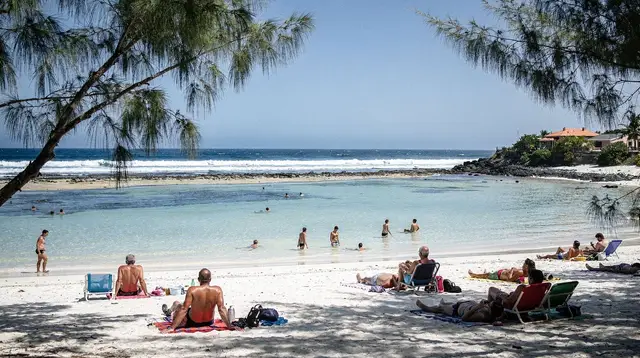
This isn’t a beach stretch. There’s no lagoon here, the swell hits the basalt cliffs directly, and swimming is banned outside surveilled lagoon zones because of shark risk — a rule that applies to the whole island, not just this coast. What you come for instead is a landscape few visitors expect from a tropical island: raw lava rock, blowholes, spice gardens and a waterfall valley, strung along a coast road that takes real time to drive even though it looks short on a map.
Where the Wild South starts and ends
Geographically, the Wild South covers the communes of Saint-Joseph and Saint-Philippe, running from the eastern edge of Petite-Île down to where the coast road (route des laves) curves back north toward Sainte-Rose on the east coast. It’s the least developed stretch of Réunion’s coastline, sitting between the more built-up south around Saint-Pierre and the greener, wetter east.
This page keeps to those two communes and the road between them. For a wider view of the south — Saint-Pierre’s market and seafront, Le Tampon, the airport at Pierrefonds — see the South region page; for the lava flows further north near Sainte-Rose, where a 1977 eruption stopped just short of the village and spared the Notre-Dame-des-Laves church, that’s a separate story covered on the east coast page.
Getting there: plan by time, not distance
From Saint-Pierre, Saint-Joseph is about a 30 to 40 minute drive along the coast. From there to the Grand Brûlé and Saint-Philippe, add another 40 to 50 minutes — so figure 1h15 to 1h30 total from Saint-Pierre to the heart of the lava coast, before any stops. The road narrows and bends along the cliff edge for long stretches, and traffic can bunch up behind slower vehicles with nowhere to pass, so kilometers on a map are a poor guide here. A rental car handles it fine; there’s no need for a 4x4 unless you’re heading up into the hills for canyoning access roads.
If you’d rather not drive it yourself, guided options range from minibus day trips to more adventurous formats. A private day trip with waterfalls covers the coast and Langevin without you worrying about where to stop, while an off-road buggy tour through the Wild South gets you onto tracks a normal car can’t reach. For something faster and higher, an island tour by helicopter departing Saint-Pierre puts the whole lava coast and the volcano’s flanks in view in under an hour — weather-dependent, and worth booking a flexible date if clouds are forecast.
Saint-Joseph: gateway to the wild coast
Saint-Joseph is the last town with real infrastructure before the coast turns properly wild — a market, a handful of restaurants, and the turn-off up the valley toward the Langevin river. It’s a reasonable base for lunch before or after the lava coast, and the town itself is worth a short walk for its role as the unofficial capital of the Wild South.
The Langevin valley, just outside town, cuts inland with a waterfall and natural pools reachable by a short, easy walk from a parking area — a good stop if you want to see moving water without committing to a full activity. For a more active visit, the valley’s canyoning routes are considered some of the most reliable on the island for a fun, not-too-technical day out. An canyoning session on the Langevin river mixes jumps, slides and abseils along a series of natural pools, and runs with a guide regardless of experience level — book ahead in high season, as groups fill up.
The coast road: Puits Arabe, spice gardens and Cap Méchant
Past Saint-Joseph, the route des laves clings to the cliff edge for the stretch toward Saint-Philippe. A few stops worth the brakes:
- Puits Arabe: a natural rock pool and blowhole formation where the swell forces water up through gaps in the basalt — dramatic to watch, not a place to swim.
- Jardins d’épices (spice gardens): small botanical gardens near Saint-Philippe growing vanilla, pepper, ylang-ylang and other crops that built the island’s plantation economy — a shaded, slower-paced counterpoint to the exposed coast.
- Cap Méchant: the most photographed viewpoint on this coast, where cliffs of black basalt take the full force of the Indian Ocean swell. There’s no beach access here worth attempting — the point is the view from above, not the water below.
None of these need more than 20 to 30 minutes each, but they add up: a full loop with stops easily fills half a day before you’ve even reached the lava fields proper.
The Grand Brûlé: where lava met the sea
The Grand Brûlé is the lower slope of the Piton de la Fournaise, the point where past eruptions have sent lava flows down to the coast and into the ocean, leaving a wide field of black rock along the route des laves. It’s the most striking landscape on this stretch of coast — layered, cooled lava in shapes that make clear how recently, geologically speaking, this ground was molten.
Be clear-eyed about what you’ll see: this is solidified rock, not flowing lava. Whether the volcano is currently active, and whether any part of the enclos is open to visitors, depends entirely on the state of alert set by the prefecture, based on monitoring from the OVPF-IPGP (Observatoire volcanologique du Piton de la Fournaise). Never plan a trip around seeing live lava — it’s a possibility during an eruption phase, not something you can schedule. For the current situation and hiking access to the crater itself, see the volcano tours guide and the self-drive or guided tour comparison.
For a broader look at the volcano and its accessible trails from the Plaine des Sables side, the Piton de la Fournaise destination page covers the route from Bourg-Murat; this page only deals with where its lava reaches the sea.
Saint-Philippe and beyond
Saint-Philippe marks the far end of the Wild South proper — a small, quiet town with a handful of guesthouses and restaurants, useful as a lunch stop or overnight base if you’re combining this coast with an early start toward the east coast the next day. Past Saint-Philippe, the route continues north into wetter, greener territory and eventually reaches Sainte-Rose, but that’s a different landscape and a different story — see the east coast page for the 1977 lava flow and Notre-Dame-des-Laves.
What to do here
| Activity | Where | Time needed | Typical price range |
|---|---|---|---|
| Coast road drive with viewpoints | Saint-Joseph to Saint-Philippe | 2–3 hours | Free (fuel + parking) |
| Langevin waterfall (lower pools) | Near Saint-Joseph | 30–45 min | Free |
| Canyoning on the Langevin river | Langevin valley | Half a day | €65–95 per person |
| Guided day trip with waterfalls | Full Wild South loop | Full day | €90–150 per person |
| Off-road buggy tour | Wild South tracks | 2–4 hours | €80–140 per person |
| Helicopter flight from Saint-Pierre | Aerial, coast and volcano | 20–45 min | €150–320 per person |
Prices are indicative ranges; check the current rate on the tour’s GetYourGuide or Viator listing before booking, since fuel surcharges and group size affect the final figure.
If you want a taste of local food along the way, a Creole cooking workshop over an open fire on Grand’Anse beach pairs well with a Wild South day, combining a beach stop (for photos, not swimming — Grand’Anse’s bassin is the exception with a protected pool) with a hands-on introduction to the island’s cuisine.
Safety and honesty about this coast
A few things worth saying plainly, because glossy write-ups of this coast tend to skip them:
- No swimming outside the lagoon. The Wild South has no protective reef, and the open swell along this coast is exactly the kind of water where the prefectural swimming ban matters most. Admire Cap Méchant and the Puits Arabe from the marked viewpoints; don’t climb down onto the rocks near the water.
- The road is slower than it looks. A short distance on the map can mean 20 minutes of tight curves behind a delivery truck. Build in slack, especially if you’re also trying to catch golden-hour light at Cap Méchant.
- Lava visibility isn’t guaranteed, ever. Treat any promise of “see the lava” in a tour description with skepticism unless it’s tied to a specific, currently active eruption phase — check Réunion Island’s weather by month and current volcanic status before you build a trip around it.
- Weather swings. This coast catches more rain than the west, and cloud can roll in and kill both photography and helicopter flights with little warning. A flexible morning slot beats a fixed afternoon booking here.
How the Wild South fits into a longer trip
Most visitors pair the Wild South with a base in Saint-Pierre or further along the west coast in Saint-Gilles, driving down for a half or full day. It also works well combined with a volcano day if you have a rental car and an early start: coast road in the morning, up to the Plaine des Sables and Pas de Bellecombe in the afternoon, weather permitting. For a structured itinerary that fits this into a wider island loop, see Réunion Island’s wild south and east coast in two days or the general road trip around the island.
If you’d rather have someone else drive and narrate the geology, the full-day Wild South tour covering waterfalls, nature and the lava route is the most complete single option, hitting Langevin, the coast road and the Grand Brûlé in one outing without you needing to plan the stops yourself. For those short on time from Saint-Gilles, a Wild South day trip from Saint-Gilles folds the drive itself into the tour.
Wild South of Réunion: frequently asked questions
Can you swim along the Wild South coast?
No. This is an open, basalt coastline with no protective lagoon, and shark risk means swimming and water sports are banned outside surveilled lagoon zones by prefectural order. Come here for cliffs, blowholes and viewpoints, not a beach day — the nearest lagoon swimming is back toward Saint-Pierre or the west coast.
How long does it take to drive from Saint-Pierre to the Grand Brûlé?
Budget 1h15 to 1h30 on the coast road (route des laves) with a couple of stops, longer if you linger at Saint-Joseph, the Puits Arabe or the spice gardens. The road hugs the coastline and rarely lets you go fast, so plan by time, not kilometers.
Is this the same lava as the 1977 eruption at Sainte-Rose?
No. The Notre-Dame-des-Laves church and the lava that stopped short of Sainte-Rose in 1977 are on the east coast, further north. The Grand Brûlé flows here are more recent eruptions of the Piton de la Fournaise that reached the sea along the Wild South, a separate site with its own layered black-rock coastline.
Can you see lava at the Grand Brûlé right now?
Usually not — what you see is solidified black lava rock from past eruptions, not active flow. Whether lava is visible depends entirely on current volcanic activity, which the Observatoire volcanologique du Piton de la Fournaise (OVPF-IPGP) monitors; never assume an eruption or an open access route before checking current status.
What is the Langevin waterfall and is it hard to reach?
The Langevin river cuts a deep valley near Saint-Joseph with a waterfall and natural pools accessible by a short walk from a parking area, plus canyoning routes higher up the valley for a more active visit. The lower pools are an easy stop; canyoning here needs a guide and booking ahead.
Do I need a 4x4 or guided tour to see the Wild South?
No, a standard rental car covers the coast road, viewpoints, Cap Méchant and the lower Langevin pools. A guided day trip, SSV buggy tour or helicopter flight adds convenience and covers spots you’d otherwise miss, but it’s not required for the main sights.
What’s the difference between this page and the South region guide?
The South region page covers Saint-Pierre and Le Tampon as a broader overview of daily life, markets and the south coast in general. This page stays focused on the Wild South itself — Saint-Joseph and Saint-Philippe, the lava coast and Langevin — as its own half-day to full-day excursion.