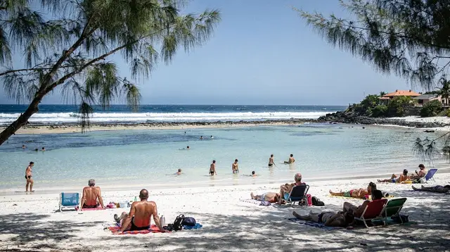
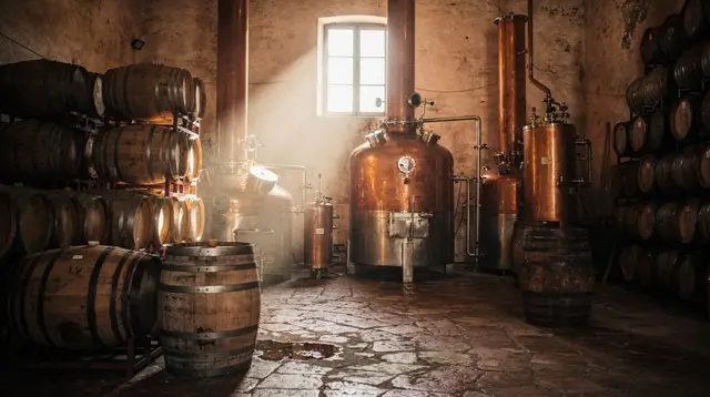
The windward coast: wetter, greener, slower
Réunion has a dry side and a wet side, and the east coast is unambiguously the wet one. This is the windward flank, facing the trade winds that blow in off the Indian Ocean, and it shows in everything: the forest comes down almost to the road, sugarcane fields stay a deeper green for longer in the dry season, and rain can arrive on a clear morning without much warning. Compare that to the west coast around Saint-Leu and Saint-Gilles, which sits in the island’s rain shadow and can go weeks without a real downpour — the two coasts are barely 40 km apart in a straight line but feel like different climates.
This page covers the stretch from Saint-André through Saint-Benoît to Sainte-Rose, sometimes grouped with Saint-Denis on maps as “North and East” but worth treating on its own: the capital is an urban, administrative story, while this coast is vanilla, sugarcane, rivers and lava. If you’re after lava fields on the other side of the island, that’s the Sud sauvage around Saint-Joseph and Saint-Philippe, fed by a different eruption and a different mood — sun-baked basalt rather than dripping green. Don’t mix the two up: the east coast’s lava story belongs to Sainte-Rose and the 1977 eruption, not to the Grand Brûlé further south.
Because of the rain, distances here are deceptive. Saint-André to Sainte-Rose is only about 30 km, but the coastal road winds through villages, crosses river mouths and slows for weather more often than the west coast does. Budget more time than the kilometres suggest, and treat a dry, sunny morning as worth rearranging your day around.
Saint-André: vanilla, sugarcane and temples
Saint-André is the gateway to the east coast coming from Saint-Denis, about 25 km and 30–40 minutes east along the coastal road when traffic is normal (longer at rush hour near the capital). It’s the historic centre of Réunion’s Indian community, with several Tamil temples that are genuinely active places of worship, not museum pieces — visitors are usually welcome to look from outside during quiet hours, but this isn’t a photo backdrop, and modest dress and a low profile are expected if you step in. If a temple festival happens to fall during your visit, it’s worth reading up beforehand rather than wandering in unprepared: see Dipavali and the Tamil temples of Réunion for what to expect and how to behave respectfully.
The other reason to stop is vanilla. Bourbon vanilla — the name for vanilla grown on Réunion and neighbouring islands using the original Bourbon-variety vines — is one of the island’s signature products, and Saint-André’s surrounding plantations are where a lot of it is grown and cured. A vanilla farm visit here usually means seeing the vines, understanding the months-long hand-pollination and curing process that makes real vanilla expensive, and tasting the difference between vanilla pods and the synthetic extract sold everywhere else. For the full story of why this vanilla costs what it does, see Bourbon vanilla in Réunion. It pairs naturally with sugarcane, which has been the other backbone crop of this coast for two centuries and still dominates the fields you drive past.
If you want a structured version of this rather than driving in cold, a farm tour built around the region’s food traditions covers vanilla, sugarcane and a local brunch in one sitting:
a farm visit and local brunch further along the east coast near Sainte-RoseSaint-Benoît and the Rivière des Marsouins
Saint-Benoît, about 10 km south of Saint-André (15–20 minutes by car), is the largest town on the east coast and the practical base for the coast’s best-known outdoor activity: whitewater on the Rivière des Marsouins. The river drains the high interior around the Plaine des Palmistes and drops through a series of pools, slides and rapids on its way to the sea, and it’s become one of Réunion’s main rafting and canyoning venues.
Rafting trips here are graded for different comfort levels but almost always involve some paddling effort and cold mountain water, even in the tropics — this isn’t a lazy float. A typical half-day outing runs a few hours including transport, briefing and the descent itself, and outfitters supply wetsuits, helmets and life jackets. It’s weather-dependent: after heavy rain the river can run too high and trips get cancelled or postponed, which on this coast happens more often than on the drier west side. For a fuller comparison of what’s on offer between the two disciplines, see rafting and canyoning in Saint-Benoît.
a whitewater rafting descent on the Rivière des Marsouins out of Saint-BenoîtFor canyoning rather than rafting — descending a river gorge on foot and by abseil and jump rather than by raft — the nearby Rivière des Roches offers a similar water-hiking format with its own set of pools and waterfalls:
a canyoning and water-hiking route on the Rivière des Roches near Saint-BenoîtInland from Saint-Benoît, the road climbs toward the Plaine des Palmistes, a high plateau village that sits at the crossroads between the east coast and the volcano route, and toward Grand Étang, a forest lake reached by a short walk that’s a popular half-day outing when the coast itself is too wet. A guided circuit through the Plaine des Palmistes, usually including lunch, is a straightforward way to see this cooler, forested side of the coast without planning your own route:
a guided circuit of the Plaine des Palmistes with lunch includedSaint-Benoît itself is a working town rather than a resort — a market, a handful of restaurants serving carri and rougail (see what to eat in Réunion Island if those names are new to you), and not much built for tourism beyond that, which is honestly part of its appeal if you’ve already spent a few days on the more polished west coast.
Sainte-Rose: Anse des Cascades and the church the lava spared
Sainte-Rose sits another 20 km or so south of Saint-Benoît — allow 30–40 minutes on a coastal road that keeps curving along river mouths and past small settlements, longer if it’s raining. This is where the east coast starts to feel like the run-up to the Sud sauvage: the vegetation thickens further, the road gets quieter, and the volcano’s presence becomes more obvious in the landscape.
The two reasons to make the trip are close together. Anse des Cascades is a small cove just north of town where a row of waterfalls drops straight into a coconut grove metres from the sea — one of the more photogenic and easy-to-reach waterfall spots on the island, with picnic tables and a short flat walk, popular with local families on weekends. It’s not a swimming beach; treat it as a scenic stop rather than a lagoon. It’s one of several worth seeking out on this side of the island; see the best waterfalls and natural pools in Réunion for others within reach of the east coast.
In Sainte-Rose itself stands Notre-Dame-des-Laves, a small church with a genuinely unusual history: during the 1977 eruption of the Piton de la Fournaise, a lava flow moved through the town and split around the building, entering through one door and stopping just short of the altar before the flow cooled. The solidified lava is still visible inside and against the church walls today. It’s worth telling this story straight — a real geological event with an odd, well-documented outcome — rather than dressing it up as a miracle for the brochure copy; the church itself doesn’t oversell it either.
Sainte-Rose is also a reasonable place to look for whale-watching operators between roughly June and October, though most whale-watching trips are run from the west coast around Saint-Gilles, where the boat infrastructure is denser — see whale and dolphin watching in Saint-Gilles for the fuller picture, or plan a dedicated trip around whale season in Réunion if seeing humpbacks is the priority.
Planning a day on the east coast
| From | To | Distance | Typical driving time |
|---|---|---|---|
| Saint-Denis | Saint-André | ~25 km | 30–40 min |
| Saint-André | Saint-Benoît | ~10 km | 15–20 min |
| Saint-Benoît | Sainte-Rose | ~20 km | 30–40 min |
| Sainte-Rose | Saint-Pierre (via the south) | ~65 km | About 1 h 30 |
A single day from Saint-Denis or the west coast is enough to see Saint-André, Saint-Benoît and Sainte-Rose without rushing too badly, provided you start early and accept that rain may reshuffle your plan. If you’re basing yourself around Saint-Gilles, see east coast day trip from Saint-Gilles for a route built around that starting point. Add a second day, or split the coast into its own overnight, if rafting or canyoning on the Rivière des Marsouins is the priority — a cancelled trip due to high water is easier to reschedule if you’re not driving straight back to Saint-Gilles that evening. Combining the two coasts into one loop is also common: see wild south and east coast in two days for a route that pairs this side of the island with the Grand Brûlé lava fields further south.
| Plan | Best for | Rough budget per person |
|---|---|---|
| Half-day drive-through (Saint-André + Sainte-Rose) | Short stopovers, road-trippers | €0–40 (fuel and snacks only) |
| Full day with a farm visit or Plaine des Palmistes circuit | First-time visitors wanting context | €60–100 |
| Two days with rafting or canyoning on the Marsouins | Active travelers | €120–200 |
Weather and when to go
There’s no getting around it: the east coast is the wettest part of Réunion, and that holds in every season, not just the cyclone months. The austral winter, from May to October, is the driest and coolest stretch here as everywhere on the island, and it’s the season to aim for if you want a realistic shot at a dry morning for Anse des Cascades or a runnable river for rafting. The austral summer, November to April, brings heavier and more frequent rain on top of being cyclone season — an outing here in January or February should be planned as a loose intention, not a fixed booking, and it’s worth building in a backup day.
Even in the dry season, don’t expect the sunny, reliable mornings of Saint-Gilles or Saint-Leu. Pack a light rain layer for any east-coast day regardless of month, and treat cancelled or rescheduled water activities as normal here rather than a sign something went wrong.
Getting there and around
A rental car is close to essential for this coast: there’s no useful rail link, and while Car Jaune buses run along the coastal road, their schedules are built around commuters and locals, not sightseeing stops at Anse des Cascades or vanilla farms. Roads are sealed and generally in good condition, but they’re two-lane, wind through town centres, and slow down noticeably in rain — leave more time than the map suggests, especially between Saint-Benoît and Sainte-Rose.
Coming from Saint-Denis or Roland-Garros airport, the east coast is a natural first- or last-day stop before or after the rest of the island. Coming from the west coast around Saint-Gilles, it’s a longer haul — figure on 1.5 to 2 hours each way — so most visitors either combine it with a loop through the south or give it a dedicated day rather than a rushed side trip.
FAQ: visiting the east coast of Réunion Island
Is the east coast worth visiting if I only have a few days on Réunion?
If your trip is short and focused on beaches and the lagoon, the west coast will serve you better. But if you have four days or more, a day on the east coast adds a genuinely different landscape — rainforest, rivers and vanilla farms — that the west and south don’t offer, and it’s an easy add-on if you’re already planning a loop of the island.
How much rain should I expect on the east coast?
More than anywhere else on Réunion, in every season. The austral winter (May–October) is comparatively drier and is the better window for outdoor plans, but a passing shower on an otherwise sunny day is normal here year-round. Bring a light rain layer regardless of when you visit.
Can I swim at Anse des Cascades?
Anse des Cascades is a scenic cove with waterfalls and picnic spots, not a swimming beach — the water here isn’t a protected lagoon. For swimming, the safe, surveilled options are on the west and south coasts, inside the lagoon around Saint-Gilles and l’Hermitage or in monitored pools further south.
Is the story about Notre-Dame-des-Laves true?
Yes. During the 1977 eruption of the Piton de la Fournaise, a lava flow moved through Sainte-Rose and split around the church, entering one doorway and stopping before the altar. The cooled lava is still visible inside today. It’s a documented event, not folklore, though it’s told locally with a fair amount of local pride.
Is rafting on the Rivière des Marsouins beginner-friendly?
Most operators offer graded trips, including options suited to first-timers, but expect real paddling effort and cold water even with a wetsuit. Trips depend on river level: after heavy rain the river can run too high and departures get postponed, which is worth knowing before you build a tight schedule around it.
How does the east coast compare to the Sud sauvage further south?
Both show signs of volcanic activity, but from different eruptions and in different settings. The east coast’s link to lava is the 1977 flow at Sainte-Rose and the spared church; the Sud sauvage’s is the more extensive Grand Brûlé lava fields near Saint-Philippe, reached from the south rather than the east. The east coast is greener and wetter overall; the Sud sauvage feels drier and more exposed, closer in character to the volcano’s summit route.
Do I need to book the rafting or canyoning trips in advance?
Yes, especially in the busier winter months (July–September) and around school holidays. Group sizes are limited and departures depend on weather and river conditions, so booking ahead — and building in flexibility for a weather-related reschedule — is the safer approach.
What should I combine with an east coast day?
The Plaine des Palmistes, on the road inland from Saint-Benoît, connects naturally to the volcano route toward Piton de la Fournaise if you have another day to spare. Coming from Saint-Denis, some visitors pair the east coast with things to do in Saint-Denis as a single loop day before heading further around the island; see driving in Réunion Island for general road-trip planning, and Réunion Island weather by month or the cyclone season guide if you’re travelling in the austral summer.
Where does the east coast fit into a full island itinerary?
Most visitors slot it in as one leg of a wider loop rather than a standalone base. If you’re planning a full circuit, see one week in Réunion Island or Réunion Island road trip around the island for where a day here fits between the capital, the volcano and the south.