Piton de la Fournaise: self-drive or guided tour
Should you drive to Piton de la Fournaise yourself or book a guided tour?
Self-drive works well if you have a rental car, are comfortable with an early-morning mountain road and can check the closure status of the Enclos Fouque yourself. A guided tour is worth it if you want someone to confirm access before you leave, explain the volcano's alert levels, or if you're not driving. Neither option can promise you'll see lava or reach Dolomieu crater — that depends entirely on the day's closure status.
Driving yourself versus booking a guide
Most people who ask about Piton de la Fournaise are really asking about the flight over the crater — the helicopter and microlight comparison covers that. This page is about something different: getting to the volcano on the ground, in a rental car, and deciding whether to do it alone or with a guide. It’s not a small choice. The Route du Volcan is a real drive, the weather window is short, and whether you get anywhere near the crater at all depends on a closure decision you don’t control.
Piton de la Fournaise is Piton de la Fournaise: hiking Réunion’s active volcano, an active shield volcano at 2,632 metres in the island’s south-east, and one of the most closely monitored volcanoes on Earth. It is not Cilaos: the road, the canyons and the climb to Piton des Neiges or the Piton des Neiges — that’s the island’s highest, extinct summit at 3,070 metres, reached from a different starting point entirely. Don’t confuse the two when you’re planning.
Driving the Route du Volcan yourself starts with the car, because the weather window is short and a closure can change your plans at the last minute. Check the cancellation and change terms before paying, and make sure the pick-up point suits an early start from the coast. You can then compare Localrent rental cars for your Réunion dates.
The self-drive route, step by step
From Saint-Gilles-les-Bains: Réunion Island’s beach town and lagoon, the drive to the volcano runs inland and up, not along the coast. You climb through the Plaine des Cafres to Bourg-Murat, then join the Route du Volcan, a paved public road with no toll and no permit requirement. It crosses the Plaine des Sables, a flat expanse of black volcanic ash and rock that looks more like a different planet than anything tropical, before ending at the Pas de Bellecombe car park at 2,311 metres.
Total driving time from Saint-Gilles is around 1 hour 45 minutes to 2 hours in a standard rental car, assuming clear roads and no stops. That’s longer than the straight-line distance suggests — this is mountain driving, with switchbacks and a steady climb, not a motorway run. Add 20–30 minutes if you stop at the Things to do at Piton de la Fournaise area’s Cité du Volcan museum in Bourg-Murat on the way, which is worth doing if you have time and useful as a backup plan if the summit is clouded in.
At Pas de Bellecombe, there’s a car park, a viewpoint over the Enclos Fouque — the vast caldera the volcano sits inside — and, on a clear morning, a first look at the Formica Leo, a small secondary cone near the crater floor. This belvedere alone, reached entirely under your own steam, is a legitimate destination even if you go no further. Plenty of visitors turn around here.
Into the Enclos: the hike to Dolomieu crater
Past the belvedere, a marked trail descends into the Enclos and climbs back up to the rim of the Dolomieu crater, the volcano’s main summit crater. Round trip, this takes around 5 hours, and it’s a real hike over uneven, sometimes loose volcanic ground with genuine elevation change on the way back up. It is not an extension of the car park walk — treat it as a separate decision, with its own shoes, water and time budget.
Here’s the part that self-drive planning often gets wrong: this trail is only open when the prefecture says it is. The Enclos Fouque is closed during eruptions and during periods of elevated volcanic alert, decided using data from OVPF-IPGP, the observatory that monitors the volcano continuously. Piton de la Fournaise erupts often by world standards, but the timing is genuinely unpredictable — nobody can tell you in advance whether the crater trail will be open on your travel date, and no operator, guided or not, can promise you’ll reach Dolomieu or see lava. If you read a version of this page that promises lava, don’t trust it.
Where a guide actually helps
A guide doesn’t get you past a closure the prefecture has ordered — nobody can. What a guide does is remove the guesswork: checking current access status before you drive up, reading the difference between a routine restriction and a closure, setting a pace and turnaround time that keeps the group safe on exposed terrain, and explaining what you’re looking at in the Enclos rather than leaving you to work it out from a signboard.
That’s genuinely useful if you’re not confident interpreting official volcanic alert information yourself, if you’d rather not be the one deciding whether conditions are safe to continue, or if you don’t have a rental car and need transport bundled with the visit. It’s less necessary if you’re comfortable driving in Réunion, checking access status before you leave your accommodation, and turning back if conditions look wrong — which is exactly what a guide would do anyway.
There’s also a middle case worth naming: travellers who are fine driving but arrive on their only clear-weather morning of the trip and don’t want to spend it puzzling over an unfamiliar alert system. In that situation, the value of a guide isn’t the driving at all — it’s not burning a rare good-weather window on uncertainty. If your trip only has one or two mornings free for the volcano, that’s a reasonable moment to pay for someone else’s judgement rather than your own.
| Self-drive | Guided tour | |
|---|---|---|
| Cost | Car rental + fuel only | Higher, transport and guiding included |
| Flexibility | You set the schedule | Fixed departure and return time |
| Access decisions | You check closures yourself | Guide checks and interprets access status |
| Best for | Confident drivers with a rental car | No car, or want closure/safety handled |
| Crater hike included | Only if you plan and time it yourself | Often built into the itinerary when open |
Timing: the one thing that matters more than the choice above
Whichever way you go, leave early. Cloud tends to build over the Plaine des Sables and the Pas de Bellecombe area from mid-morning, and a summit that’s clear at 7am can be socked in by 10am. Most visitors who report a wasted trip left too late, not because they chose the wrong option between self-drive and a guide.
Temperature is the other thing people underestimate. Pas de Bellecombe sits above 2,300 metres, and dawn temperatures can sit close to 0°C even when it’s a warm morning down on the coast at Saint-Gilles or Saint-Pierre: the South’s capital, markets and seafront. Bring a proper windproof layer regardless of how the weather looks when you leave your accommodation — the exposed plateau at the top has no shelter and the wind picks up fast.
Season matters less than you’d expect for access — closures follow volcanic activity, not the calendar — but the dry austral winter (May to October) generally gives more reliable clear-sky mornings than the wetter austral summer. Check current Travel tips for Reunion Island and road status before you set out either way.
Altitude, fitness and who should think twice about the crater hike
Pas de Bellecombe sits above 2,300 metres and the Dolomieu rim is higher still, so this isn’t a casual walk even before you factor in the terrain. Some visitors feel the altitude as light breathlessness or a mild headache on the climb back out of the Enclos — nothing most healthy adults can’t manage with a steady pace and water, but worth knowing about if you’ve never hiked at this elevation before. The belvedere itself, reached straight from the car park, involves no real altitude exertion and is a fine stop even if the crater hike isn’t for you.
The crater trail is a different matter: loose volcanic ground, uneven steps carved into rock, and a genuine climb back up out of the Enclos at the end of a long day. It isn’t stroller-friendly and isn’t the place to bring young children who tire easily on uneven terrain — for hikes better suited to families, see Family-friendly hikes in Réunion Island, and for what’s realistic with limited mobility across the island generally, Is Reunion Island accessible for reduced mobility? is a better starting point than this page.
If you’re building a longer hiking trip around the island’s best trails rather than this one specifically, Best hikes in Réunion Island, sorted by time and effort covers the range, including the very different, much longer climb up Piton des Neiges summit hike: the roof of the Indian Ocean from Cilaos — don’t plan for both summits on the same trip day, they’re on opposite sides of the island and each deserves its own morning.
Fitting the volcano into the rest of your trip
Most visitors treat Piton de la Fournaise as one day within a longer stay rather than the whole point of the trip, and it’s worth deciding where that day sits before you book anything. If you’re mapping out a full itinerary, One week in Réunion Island: cirques, volcano and the wild south and Five days in Réunion Island: the west coast and cirques both show where a volcano day fits alongside the cirques and the coast, and 3 days in Réunion Island: lagoon, volcano and Cilaos is the tighter version if your trip is short. For a dedicated look at making the volcano the anchor of one specific day from Saint-Gilles, Piton de la Fournaise: a day trip from Saint-Gilles walks through the timing in more detail than this page does.
The volcano’s south-east location also puts it close to the Sud sauvage — the wild coastline around Saint-Joseph and Saint-Philippe where old lava flows meet the sea. Travellers with a rental car sometimes combine an early volcano morning with an afternoon down that coast rather than driving all the way back to Saint-Gilles and out again another day; Wild South and east coast in two days lays out that kind of pairing if you want to make the most of having the car up in the highlands already.
After an early start, unwinding back on the coast
Both self-drive and guided visits to the volcano tend to start before dawn and finish by early afternoon, which leaves the rest of the day free once you’re back down at sea level — and after several hours on exposed volcanic terrain, most people would rather not spend it on another hike. Saint-Gilles itself has plenty to fill that gap; Things to do in Saint-Gilles-les-Bains covers the options, and for something low-effort that pairs naturally with a tiring morning, a relaxing catamaran cruise along the west coast is a reasonable way to spend the afternoon without asking anything more of your legs. If sunset cruises specifically are more your pace, Saint-Gilles catamaran and sunset cruises covers that in more depth.
If the volcano is closed the day you go
It happens, and no one can predict it far in advance. The Cité du Volcan in Bourg-Murat, on the way up, explains the volcano’s eruptive history and the monitoring network in a way that makes the closure system make sense rather than feel arbitrary. It’s a reasonable stop even if you do reach the crater trail, and a solid fallback if you don’t.
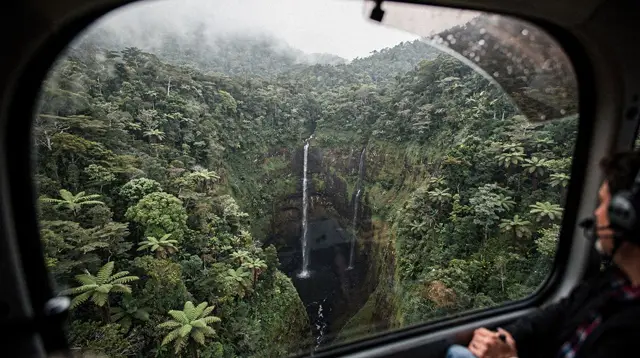
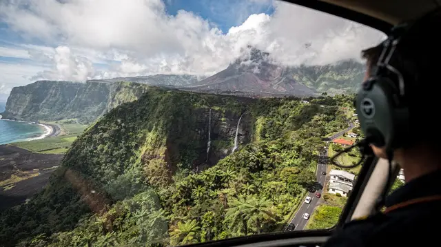
For a different kind of access to the same landscape, a scenic flight shows the crater and lava fields from above regardless of whether the ground trail is open, though it depends on its own separate weather window and isn’t guaranteed either. For an overview of that option specifically:
a helicopter flight departing from Saint-Gilles that passes over the volcano and the island’s cirquesIf you’d rather see the volcano as one stop within a wider day covering the island’s main landmarks rather than planning the drive yourself, a full-island tour bundles it in:
a guided full-day tour covering the island’s main sights across 13 stops, including the volcano areaPractical notes before you go
Fuel up before leaving Saint-Gilles or Saint-Pierre — there’s nothing at the top. Mobile signal is patchy to absent around the Plaine des Sables and Pas de Bellecombe, so download offline maps and tell someone your plan if you’re hiking into the Enclos. Toilets and a small snack kiosk exist at the Pas de Bellecombe car park, but don’t rely on much beyond that.
Check road and trail status the morning you leave, not the night before — conditions and closures can change overnight. If you’re combining the volcano with other parts of the island in the same trip, see Three cirques in four days: Cilaos, Salazie and Mafate by road or Piton de la Fournaise volcano weekend for how it fits alongside Cilaos and Salazie. For wider planning around driving conditions on the island generally, see Driving in Réunion Island: what the roads are actually like and Renting a car in Réunion Island.
Piton de la Fournaise access: frequently asked questions
Can I drive myself to Piton de la Fournaise?
Yes. The Route du Volcan is a public road from Bourg-Murat, in the Plaine des Cafres, across the Plaine des Sables to the Pas de Bellecombe car park at 2,311 metres. A standard rental car handles it fine in dry conditions; no permit or guide is required to drive it.
How long does the drive from Saint-Gilles take?
Budget around 1 hour 45 minutes to 2 hours from Saint-Gilles-les-Bains to the Pas de Bellecombe car park, mostly on mountain roads through the Plaine des Cafres. Add time if you stop at the Cité du Volcan or if cloud slows the final stretch across the Plaine des Sables.
Is the hike to Dolomieu crater always open?
No. The Enclos Fouque, which the trail from Pas de Bellecombe crosses to reach the Dolomieu crater rim, is closed by the prefecture during eruptions and periods of elevated seismic alert. Closures are decided day to day by OVPF-IPGP monitoring and can change with little notice.
How long is the hike to the crater if the Enclos is open?
Around 5 hours round trip from Pas de Bellecombe to the Dolomieu crater rim and back, over uneven volcanic terrain with real elevation change. It is not a stroll — sturdy shoes, water and a windproof layer are needed even when the weather looks clear at the car park.
Is a guided tour worth it if I already have a rental car?
A guide adds value mainly for reading closure and safety information correctly, explaining what you’re looking at in the Enclos, and setting a realistic pace and turnaround time. If you’re confident checking official access status yourself, self-drive to Pas de Bellecombe and the belvedere is straightforward without one.
Will I see lava?
Don’t plan the trip around it. Piton de la Fournaise is genuinely one of the world’s most active volcanoes, but eruptions are frequent and unpredictable, not scheduled. Most visits to Pas de Bellecombe involve no visible lava at all, just the crater landscape, the Formica Leo and views into the Enclos.
What should I wear and bring?
Layers. Temperatures at Pas de Bellecombe can sit close to 0°C at dawn even when Saint-Gilles is warm and sunny, and wind picks up fast on the exposed plateau. Bring water, a hat, a windproof jacket and sturdy shoes if you’re hiking into the Enclos, and start early before cloud rolls in.
What’s the alternative if the volcano is closed or the road is clouded in?
The Cité du Volcan museum in Bourg-Murat explains the volcano’s history and monitoring system and works as a plan B in poor weather. A scenic flight is a separate option that shows the crater and lava fields from the air regardless of ground access, though it depends on its own weather window.
Compare top-rated excursions on GetYourGuide
Verified deep-linked GetYourGuide tours. Book through these links and we earn a small commission at no cost to you.
GetYourGuide does not provide a product photo for this activity — the image shows the meeting point, photographed by us.