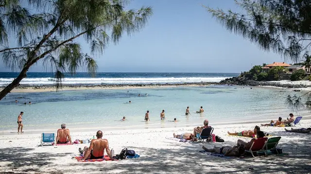
Wild South and east coast in two days
Most short itineraries on this island send you uphill, toward the volcano or the cirques. This one stays low and close to the water. It links the Wild South and the east coast in a single coastal loop, with no trailhead and no altitude gain worth mentioning. If you want the Piton de la Fournaise added to a similar route, that’s a different, longer day covered in Piton de la Fournaise volcano weekend; this page deliberately leaves the volcano out.
The route runs from Saint-Pierre or Saint-Joseph through the lava fields of the Grand Brûlé to Sainte-Rose, then north to Saint-Benoît and Saint-André. Distances on the map look short. They are not short in minutes: this coast road bends constantly, crosses one-lane bridges over ravines, and slows to a crawl through village centres. Treat every distance below as a travel-time estimate first, a kilometre figure second.
Why this route and not a longer one
The Wild South and the east coast share a climate and a landscape logic that the rest of the island doesn’t: they face the trade winds, so they’re the wettest and greenest parts of Réunion, in contrast to the dry west coast around Saint-Gilles. Rain here is frequent, often brief, and part of the deal — bring a light rain shell and don’t expect two dry days in a row, especially outside the austral winter (May to October). For a broader read on when to time a trip around this, see Réunion Island cyclone season: a booking and safety guide if you’re travelling between November and April.
This itinerary is built for travellers who want to see lava reach the sea, walk a black-sand cove, and visit a vanilla farm and Tamil temples, without committing to a multi-hour hike or a pre-dawn volcano start. If that’s not enough for your trip, it slots naturally into a longer loop — see 3 days in Réunion Island: lagoon, volcano and Cilaos for how to extend it.
Day 1: Saint-Joseph, Saint-Philippe and the Grand Brûlé
Start from Saint-Pierre or wherever you’re based on the south coast. Getting to Saint-Joseph takes roughly 30 to 40 minutes by car; from there to Saint-Philippe is another 20 minutes, more if you stop at roadside stalls or the spice gardens along the way.
Saint-Joseph itself is worth a short stop: the Grande Mosquée and the black-basalt church front are easy to see on foot in 20 minutes. Push on to Saint-Philippe, then continue toward Cap Méchant, a stretch of dark cliffs where the Indian Ocean hits basalt with real force. There’s no beach to swim from here — the water is rough and the currents unpredictable, and this is one of the areas where swimming outside the lagoon or a supervised zone is against prefectural rules, not just poor judgement. Walk the viewpoint, don’t wade in.
From Cap Méchant, the road continues into the Grand Brûlé, the vast lava field left by decades of eruptions from the Piton de la Fournaise. Several lava flows here have reached the ocean, most memorably in 1977, 1986 and 2007, and you can still see where the black rock meets the waterline. The Route des Laves signposts a few short pull-offs explaining specific flows; none require more than a 10-to-15-minute walk from the car. This is the one place on the itinerary where the volcano is visible in its effects without you climbing it.
Plan lunch around Saint-Philippe or Le Baril — grilled fish, rougail, or a creole plate at a roadside table is the norm, typically €12 to €20 per person. If you want a guided, hands-on version of this half of the route, a Wild South tour covering waterfalls, the lava route and local nature is a reasonable way to do it without navigating every turn yourself:
a half-day tour through the Wild South’s waterfalls and lava routeFor a faster-paced alternative that covers similar ground:
an SSV buggy trip through the Wild South’s back roadsBy mid-afternoon, continue north to Sainte-Rose, about 30 to 45 minutes from the Grand Brûlé depending on stops. This is where day 1 and day 2 overlap slightly on the map — some travellers push straight through to Sainte-Rose for the night, others backtrack to Saint-Pierre and start day 2 fresh. Either works; the route description below assumes you overnight near Sainte-Rose or Saint-Benoît to avoid backtracking twice.
If canyoning appeals more than a scenic drive, the Langevin river near Saint-Joseph is one of the most accessible spots on the island for it, and it fits neatly before or after the coastal drive:
a half-day canyoning outing on the Langevin riverDay 2: Sainte-Rose, Saint-Benoît and Saint-André
Start the day at the Anse des Cascades near Sainte-Rose, a cove where a row of waterfalls drops straight into a coconut grove above black rocks. It’s a flat, easy walk — 15 to 20 minutes round trip — and one of the better picnic spots on the east coast if the weather holds. Nearby, the small church of Notre-Dame-des-Laves is worth the five-minute detour: the 1977 lava flow split around it and spared the building, leaving the black rock visibly pressed against its walls. It’s a striking, low-key stop, not a major attraction, and you won’t need more than 10 minutes there.
If you’d rather see this stretch of coast, plus the waterfalls of the interior, from the air, a helicopter flight departing from the south is the honest way to do it — weather-dependent and worth booking with flexibility in mind:
a helicopter flight over Réunion’s waterfalls and river basinsFrom Sainte-Rose, the drive to Saint-Benoît takes about 30 to 40 minutes along the coast road, which narrows and winds through several small settlements. Saint-Benoît is a working town rather than a tourist stop, but it’s the gateway to the Rivière des Marsouins and a common base for canyoning and rafting on the island’s wettest river systems.
Continue north to Saint-André, another 20 to 25 minutes away, for the vanilla side of the east coast. This area produces most of the island’s “Bourbon” vanilla, and small farm visits explain the curing process in ways a supermarket vanilla pod never will. Saint-André is also home to some of Réunion’s most visible Tamil temples, a legacy of 19th-century indentured labour migration from South India — worth a respectful visit if a ceremony or open day happens to align with your dates.
From Saint-André, you’re roughly an hour from Saint-Denis and the Roland-Garros airport if that’s your next stop, or about two hours back to Saint-Pierre if you’re closing the loop south.
Honest logistics
| Leg | Distance (approx.) | Drive time (realistic) |
|---|---|---|
| Saint-Pierre to Saint-Joseph | 25 km | 30–40 min |
| Saint-Joseph to Saint-Philippe | 15 km | 20 min |
| Saint-Philippe to Grand Brûlé viewpoints | 10–15 km | 20–30 min with stops |
| Grand Brûlé to Sainte-Rose | 20 km | 30–45 min |
| Sainte-Rose to Saint-Benoît | 20 km | 30–40 min |
| Saint-Benoît to Saint-André | 15 km | 20–25 min |
| Saint-André to Saint-Denis | 35 km | 45–60 min |
Fuel up before leaving Saint-Pierre or Saint-Joseph; stations thin out along the Wild South and the Grand Brûlé stretch. A rental car is close to essential for this route — see Driving in Réunion Island: what the roads are actually like for the basics of driving on the right and reading local road signage.
What this itinerary leaves out on purpose
This is a coastal loop, not a hiking or volcano itinerary. It skips the Piton de la Fournaise’s crater trail, the cirques, and anything above a few hundred metres of elevation. If you want the same Wild South starting point combined with the volcano’s Pas de Bellecombe viewpoint, that’s covered separately in Piton de la Fournaise volcano weekend — a longer, earlier-starting day because of the altitude and the fog that typically rolls in by late morning.
It also skips swimming stops. The Wild South and east coast are not lagoon coastline: there’s no coral barrier here, the surf is often rough, and open-water swimming and watersports outside the lagoon or supervised zones are restricted by prefectural order because of shark risk. If a swim is part of your plan, save it for Saint-Gilles or another West Coast lagoon town on a different day. More on where swimming is actually allowed: Is it safe to swim in Réunion? Sharks, the law, and the lagoon.
Practical notes for these two days
Bring cash for smaller stalls and farm stops in Saint-Philippe, Sainte-Rose and Saint-André — card readers are less consistent than on the west coast. Expect rain at some point on this route; it’s normal for the east coast and rarely lasts all day. Roads through the Grand Brûlé and along the coast can close temporarily after heavy rain or rockfall, so check conditions the morning you leave rather than assuming the route is always open. For a broader look at what things typically cost across the island, see Reunion Island trip cost: a budget breakdown or the budget tool.
For general safety context beyond swimming — driving, wildlife, health — see Is Reunion Island safe for tourists?.
FAQ about the Wild South and east coast two-day route
Do you need to hike for this itinerary?
No. This route is entirely road-based, with short walks of 10 to 20 minutes to viewpoints, waterfalls and the Anse des Cascades. It’s a deliberate alternative to the island’s hiking-heavy itineraries.
Can you swim anywhere along this route?
Not really, and you shouldn’t try outside marked, supervised areas. The Wild South and east coast face open ocean and rough surf, and open-water swimming outside the lagoon or protected zones is restricted for shark-safety reasons. Save swimming for the lagoon around Saint-Gilles or Saint-Leu.
How much driving is involved over the two days?
Roughly three to four hours of driving total, spread across the two days, but on narrow, winding coast roads. Add time for stops rather than treating the kilometre totals as your schedule.
Is the Grand Brûlé lava field safe to visit?
Yes, the marked pull-offs and short trails along the Route des Laves are open to the public outside active eruption periods. Check current road status the morning of your visit, since heavy rain or an active eruption elsewhere on the volcano can prompt temporary closures.
Should this itinerary include the Piton de la Fournaise?
Not as written. This route stays coastal and skips the volcano’s altitude and driving time entirely. If you want to add the volcano, follow piton-de-la-fournaise-volcano-weekend instead, which builds in the extra hours and the early start that a crater-rim hike requires.
What’s the best time of year for this coastal loop?
Austral winter, from May to October, gives the driest and most predictable weather, though the east coast stays greener and wetter than the west year-round. Avoid pushing through this route during a cyclone alert between November and April.
Where should you stay for these two days?
Saint-Pierre or Saint-Joseph works well as a base for day 1, with Saint-Benoît or Saint-André convenient for day 2 if you don’t want to backtrack. Both options keep drive times reasonable given the coast road’s pace.
tours.2 days
Verified deep-linked GetYourGuide tours. Book through these links and we earn a small commission at no cost to you.
GetYourGuide does not provide a product photo for this activity — the image shows the meeting point, photographed by us.