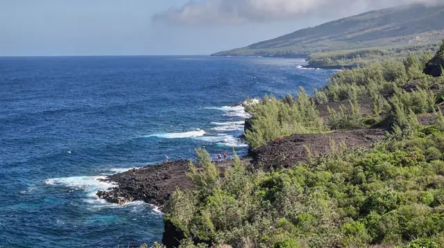
Piton des Neiges summit hike: the roof of the Indian Ocean from Cilaos
How do you hike Piton des Neiges, and is it the same as the volcano?
Piton des Neiges (3,070m) is Réunion's highest point, an extinct volcano reached on foot from Cilaos, usually with a night at the Caverne Dufour gîte before a pre-dawn summit push. It is a separate mountain from Piton de la Fournaise, the active volcano in the south-east; the two are never climbed on the same hike.
One mountain, one route, one night on the way up
Piton des Neiges is the highest point in Réunion and in the entire Indian Ocean, at 3,070m. It is an extinct volcano at the geographic centre of the island, and the hike to its summit is one trip, not a multi-day traverse: a linear route from Cilaos, a night at altitude, and a pre-dawn push to stand on top as the sun comes up over the cirques. This page covers that single climb. If you’re planning several days moving between huts across Mafate, with no road in or out, that’s a different trip covered in the guide to hiking in Mafate. If what you actually want is the smoking crater in the south-east, that’s Piton de la Fournaise, and it’s a separate mountain entirely - more on that below, because it’s the single most common mix-up visitors make.
This guide is filed under Saint-Gilles-les-Bains because that’s where most visitors are based on the west coast, but the trailhead itself is inland, above Cilaos, reached by the mountain road with its roughly 400 bends. Budget the best part of a day just to get to the start of the trail.
Piton des Neiges vs Piton de la Fournaise: not the same mountain
It’s worth being blunt about this, because the names are easy to confuse and the confusion sends people to the wrong side of the island.
| Piton des Neiges | Piton de la Fournaise | |
|---|---|---|
| Altitude | 3,070m | 2,632m |
| Status | Extinct volcano | Active volcano, erupts periodically |
| Location | Island centre, above Cilaos | South-east, above Bourg-Murat |
| Access | On foot only, from Cilaos, via Caverne Dufour | Road to Pas de Bellecombe, then a marked trail into the enclos |
| Typical visit | Overnight hike, sunrise summit | Day trip, weather and eruption-status dependent |
| What you see | 360-degree island views, the three cirques | The Dolomieu crater, lava fields, sometimes active lava |
If you only have time for one, decide first whether you want a physical, sunrise-summit hike (Piton des Neiges) or a shorter, more accessible walk to a volcanic crater that may or may not be open depending on eruption activity (Piton de la Fournaise, covered in the volcano tours guide and the day trip guide). Doing both is possible on a longer trip, but they don’t combine into a single outing - they’re roughly opposite sides of the island, each with its own long drive.
The route: Cilaos to the Caverne Dufour to the summit
The standard route starts at the trailhead near Cilaos, either from the town itself or from the Bras-Sec side, and climbs steadily through changing vegetation - tamarind forest lower down, giving way to heath and bare rock closer to the summit. The full round trip from Cilaos covers roughly 12 to 14 hours of walking spread over two days, with a night at the Caverne Dufour gîte (around 2,480m) breaking the climb in two.
Day one: walk from Cilaos (or a drop-off point on the Bras-Sec road) up to the Caverne Dufour, typically 3 to 4 hours of steady climbing. Arrive with daylight to spare, eat, and get some sleep before a very early start.
Night: leave the gîte in the dark, usually between 3:00 and 4:00, headlamp on. The final push to the summit is around 1 to 1.5 hours, timed to reach the top for sunrise. This is the part of the hike people remember: the silhouettes of the cirques appearing below as the sky lightens, and on a clear morning, a shadow of the peak itself cast across the clouds to the west.
Descent: back down to the Caverne Dufour for a late breakfast, then continue down to Cilaos, arriving early-to-mid afternoon.
Some very fit hikers do the whole thing in a single very long day without the overnight stop, but this removes the sunrise reward, adds significant fatigue and altitude strain, and leaves no buffer if weather turns. Nearly everyone who does this hike well plans it as an overnight.
| Stage | Distance | Typical time |
|---|---|---|
| Cilaos to Caverne Dufour | Around 6 km | 3-4 hours |
| Caverne Dufour to summit | Around 2 km | 1-1.5 hours (pre-dawn) |
| Summit to Cilaos (return) | Around 8 km | 4-5 hours |
Distances are short on paper; the effort is almost entirely about elevation gain and altitude, not horizontal ground covered. Don’t judge the hike by the kilometres.
The Caverne Dufour: book it before you plan anything else
The Caverne Dufour gîte is the fixed point around which this whole hike is built, and it has a limited number of dormitory beds. During the austral winter hiking season (May to October) and around school holidays, it fills up weeks in advance. There is no realistic backup shelter near the trail, and arriving at altitude at dusk without a confirmed bed is not a situation to plan for. Book the gîte first, then build your Cilaos dates around the reservation - not the other way round.
Expect basic dormitory-style accommodation with meals available (often half-board, dinner and breakfast), no heating beyond what the building itself provides, and cold running water at best. It’s a working mountain hut, not a hotel, and that’s part of the experience - but it means packing a warm sleeping layer regardless of season.
Cold at altitude, even in a tropical destination
It’s easy to forget, arriving from the lagoon at Saint-Gilles or the beaches of the west coast, that 3,070m in the austral winter can sit close to 0°C before dawn, with wind chill making it feel colder still. Pack for genuine cold: a warm insulating layer, hat, gloves, and a windproof shell, on top of the daytime hiking layers. Even in the austral summer (November to April), night temperatures above 2,000m are cool enough to need a proper layer, though summer brings its own problems - afternoon cloud build-up, heavier rain, and the cyclone season risk that can close trails with little warning (see the cyclone season guide and weather by month).
A headlamp with spare batteries is essential, not optional - the summit push happens entirely in the dark. Sturdy hiking boots, trekking poles for the descent, at least 1.5 to 2 litres of water, and food for two days round out the kit; see the general packing guide for the rest of a Réunion trip.
When to go
The austral winter (May to October) is the more reliable season: drier trails, clearer skies, and better sunrise odds, at the cost of colder nights at altitude. The austral summer (November to April) brings warmer air but more cloud, heavier rain, and the cyclone season, when trail closures can happen with little notice and a booked gîte night can be lost to weather. For a first attempt, winter is the safer bet; check the best time to visit guide for how this fits the rest of an island itinerary.
Whatever the season, check trail status with the ONF before setting out - closures happen after heavy rain or rockfall, and a closed trail is a closed trail regardless of how good the forecast looks from the coast.
Getting to the trailhead
There’s no way around the drive: reaching Cilaos means the mountain road from Saint-Louis, with its roughly 400 bends, typically an hour of careful driving without stops. Budget a half-day for the drive up, gear check and gîte check-in before starting to walk. The guide to driving the Cilaos road has the detail on what to expect; the Cilaos day trip guide and things to do in Cilaos cover the town itself if you’re building in an extra day either side of the hike.
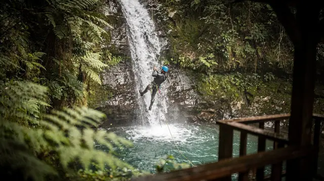
Cilaos is also the base for the island’s best canyoning, covered separately in the canyoning guide - a good add-on for a rest day before or after the summit push, though not something to combine with the hike itself.
What else to see from up there and around it
The reward at the top, weather allowing, is a 360-degree view: the three cirques (Cilaos, Salazie and Mafate) laid out below, the coastline beyond, and on the clearest mornings, Piton de la Fournaise visible across the island to the south-east - a useful moment to actually see, at a distance, the mountain that’s so often confused with the one you’re standing on.
For those who’d rather see the summit from the air than climb it, or want an aerial view to complement the hike, a scenic flight is the other way to take in Piton des Neiges and the cirques together:
a helicopter flight from Saint-Gilles that crosses the cirques and the high peaks, including Piton des Neiges, for those who’d rather see it from the airFor a longer stay that puts this hike into the context of a full island trip, a multi-stop island tour is a way to see the rest of Réunion around the climb:
a full-day guided tour covering the island’s major sights in 13 stops, a way to see the rest of Réunion around a Cilaos-based hiking tripAfter two days on the mountain, most hikers head back to the coast for something considerably gentler. A boat trip out of Saint-Gilles is the classic way to decompress:
a dolphin and whale watching boat trip from Saint-Gilles-les-Bains, a easy contrast to a couple of days climbing at altitudeAnd for a taste of the island’s other mountain tradition - distilling rather than hiking - a short detour to an artisanal rhum arrangé workshop rounds out a Cilaos-to-coast trip:
a guided visit to an artisanal rhum arrangé workshop in Saint-Paul, a relaxed way to end a hiking-focused stayPlanning it around the rest of your trip
This hike needs two full days minimum - one for the climb and gîte night, one for the descent and recovery - plus the drive to and from Cilaos on either side. It slots naturally into a longer island itinerary; the three cirques in four days itinerary is built around exactly this kind of high-altitude, multi-cirque trip. If you’re weighing whether the guided volcano day trip to Piton de la Fournaise or the self-guided Piton des Neiges summit suits you better, the self-drive or guided tour comparison covers the other mountain in detail, and the general best hikes in Réunion guide puts this climb in context against the island’s other trails.
Piton des Neiges summit hike FAQ
Is Piton des Neiges the same mountain as Piton de la Fournaise?
No. Piton des Neiges (3,070m) is an extinct volcano at the island’s centre, above Cilaos, and is Réunion’s and the Indian Ocean’s highest point. Piton de la Fournaise (2,632m) is the active volcano in the south-east, reached from Bourg-Murat and the Plaine des Sables. They sit on opposite sides of the island and require separate trips.
Do I need to sleep at the Caverne Dufour gîte?
Almost everyone does. The round trip from Cilaos is roughly 12 to 14 hours of walking, so hikers climb partway on day one, sleep at the Caverne Dufour gîte (around 2,480m), then leave in the dark for a 1 to 1.5 hour final push to reach the summit at sunrise. Doing it all in a single day from Cilaos is possible but exhausting and leaves no margin for weather.
How cold does it get at the summit?
In the austral winter (May to October), pre-dawn temperatures at the Caverne Dufour and the summit can sit close to or below 0°C, with wind chill making it feel colder. Even in the austral summer, nights above 2,000m are cool. A warm layer, hat, gloves and windproof shell are not optional.
Do I need to book the Caverne Dufour gîte in advance?
Yes, and well ahead, especially during the austral winter hiking season and school holidays. The gîte has limited dormitory beds and does not take walk-ins reliably; arriving without a reservation risks being turned away with no other shelter nearby.
How hard is the Piton des Neiges hike?
It is a long, high-altitude trek rather than a technical climb: well-marked trail, some scrambling near the summit, but a serious effort at altitude with an early, dark start. Good fitness, sturdy boots and a headlamp are essential; it is not a casual half-day walk.
Can I drive close to the summit or see it from Saint-Gilles?
No. There is no road to the Caverne Dufour or the summit; the trailhead is reached from Cilaos, itself a slow mountain drive from the west coast. Piton des Neiges is not visible as a single dramatic peak from Saint-Gilles - it sits inland, behind the Hauts, and is best appreciated on the mountain itself or from a scenic flight.
What’s the best season to attempt the summit?
The austral winter, May to October, gives the driest trails and the clearest sunrise odds, though it is also the coldest window. The austral summer (November to April) brings afternoon cloud, heavier rain and cyclone-season risk, which can close trails with little notice.
Guided hikes in the cirques and mountains on GetYourGuide
Verified deep-linked GetYourGuide tours. Book through these links and we earn a small commission at no cost to you.
GetYourGuide does not provide a product photo for this activity — the image shows the meeting point, photographed by us.