Piton de la Fournaise: a day trip from Saint-Gilles
Can you visit Piton de la Fournaise on a day trip from Saint-Gilles?
Yes. Count roughly 2 to 2.5 hours of driving each way from Saint-Gilles to the Pas de Bellecombe via Bourg-Murat, plus 3 to 5 hours if you add the hike toward the Dolomieu crater. Leave before sunrise, since cloud usually rolls in by late morning and the crater trail is sometimes closed by the prefecture.
Why Piton de la Fournaise from the west coast is a long day, not a stroll
Most visitors staying in Saint-Gilles or the Hermitage look at the map, see roughly 60 kilometres to the volcano, and assume an hour’s drive. It isn’t. The road climbs from sea level to over 2,300 metres, threading through Saint-Louis, Le Tampon and Bourg-Murat before crossing the Plaine des Sables, a bare volcanic plateau that feels closer to the surface of the moon than to a tropical island. Between traffic near Saint-Louis, the winding climb, and the final stretch across the plain, budget 2 to 2.5 hours each way. That’s before you’ve parked at the Pas de Bellecombe or laced up your boots.
This page treats the visit exactly as it plays out from the coast: an early start, a real driving commitment, a genuine chance the crater trail is closed, and a cold, possibly cloudy arrival even in the middle of a Réunion summer. It won’t promise you lava. It won’t pretend the enclos Fouque is always open. What it will do is lay out the honest logistics so you can decide whether to drive yourself, book a guided hike, or take to the air instead.
The route: Saint-Gilles to the Pas de Bellecombe
From Saint-Gilles, the standard route runs south along the coast to Saint-Louis, then turns inland and climbs through Le Tampon toward the Plaine des Cafres. At Bourg-Murat, the volcano road (RF5, sometimes signed as the Route du Volcan) branches off and climbs further still, crossing the stark, ash-grey expanse of the Plaine des Sables before reaching the Pas de Bellecombe car park at 2,311 metres.
| Leg | Approx. distance | Approx. drive time |
|---|---|---|
| Saint-Gilles to Saint-Louis | 25 km | 30–40 min |
| Saint-Louis to Bourg-Murat | 35 km | 45–60 min |
| Bourg-Murat to Pas de Bellecombe | 25 km | 40–50 min |
| Total, one way | ~85 km | ~2–2.5 h |
Those are drive times, not distances you can eyeball on a map. The final stretch across the Plaine des Sables is slow by design: a narrow road, blind curves, and a landscape worth slowing down for anyway. If you’re coming from Saint-Pierre instead, the drive up through Le Tampon is somewhat shorter, but the Bourg-Murat to Pas de Bellecombe leg is identical either way.
Fuel up before you leave the coast — there’s nothing at the Pas de Bellecombe beyond a car park and a small refuge — and check the driving conditions guide if this is your first mountain road on the island. Roads here reward patience more than horsepower.
Leave before sunrise: the fog isn’t a maybe
This is the detail that trips up more day-trippers than any closure notice: cloud builds over the Plaine des Sables and the Pas de Bellecombe from around mid-morning onward, most days of the year. A summit that’s brilliantly clear at 7am can be socked in by 10:30am, with visibility down to a few metres and the entire enclos hidden from view.
The practical result is that a genuinely worthwhile visit means leaving Saint-Gilles by 5:30 or 6am, arriving at altitude while the sky is still clean, and treating anything after mid-morning as a bonus rather than a plan. If you’re travelling with people who aren’t early risers, that’s worth negotiating before the trip, not at 6am in the car park. For the fastest, most reliable read on conditions, check the weather the evening before rather than the morning of — mountain weather here changes quickly and forecasts more than a day out aren’t worth much.
It’s also genuinely cold at that altitude before the sun is properly up. In the austral winter (May to October), temperatures near the Pas de Bellecombe can sit close to 0°C at dawn, a jarring contrast with the 20-plus degrees you left behind on the coast. Bring a real jacket, not just a light layer — see what to pack for Réunion if you’re building your trip kit from scratch.
What you’ll actually find at the top
The Pas de Bellecombe is a viewpoint in its own right: a rim overlooking the enclos, the vast caldera that contains the active cone, with the small Formica Léo crater visible below. Many visitors stop here, take in the view, and turn back — a reasonable choice if time or fitness is limited, since the overlook alone justifies the drive on a clear morning.
For those continuing, the marked trail descends into the enclos and crosses roughly 4 kilometres of lava terrain to the base of Dolomieu, the main crater, then climbs to the rim. Round trip, this runs about 5 hours, over uneven, exposed volcanic rock with no shade and no water source en route. It is not technical, but it is a genuine hike: sturdy footwear, more water than you think you’ll need, sun protection despite the altitude, and a realistic look at your own fitness before committing.
None of this happens if the enclos is closed. During an eruption, or when the OVPF-IPGP observatory flags elevated volcanic risk, the prefecture shuts access to the enclos Fouque and the crater trail — sometimes with little notice. Réunion’s volcano erupts often by global standards, but exactly when and whether the trail will be open on your specific day is not something any tour operator or guidebook can promise. Check the status before you drive up; see can you visit during an eruption for how the closures actually work in practice.
Self-drive or guided: what actually changes
Driving yourself gives you control over timing, which matters given how weather-dependent this trip is — you can leave at 5am if the forecast looks perfect, or bail early if it doesn’t. It also means you’re responsible for checking closures, reading the mountain road safely, and turning back if the situation changes.
A guided hike removes that planning burden. Guides who work the mountain daily generally have a sharper read on whether a given morning is worth the drive, and a scheduled departure forces the early start that self-drivers often talk themselves out of.
a guided hike into the enclos toward the Dolomieu crater bundles transport logistics with local knowledge of trail conditions, which is worth something on a day where the difference between a clear crater view and a wasted drive can come down to an hour’s timing.
For a lower-commitment version that still gets you to altitude with a group, a public guided hike to the volcano covers the same overlook and, conditions permitting, the crater trail, without arranging your own transport from the coast.
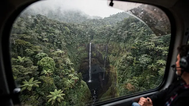
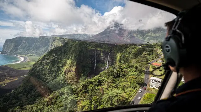
If the idea of a 5-hour lava-field hike doesn’t appeal, or if you want to see the scale of the enclos without walking into it, a scenic helicopter flight over the volcano covers the caldera, the cone, and often Mafate or the Trou de Fer in the same outing — and it isn’t blocked by an enclos closure the way a ground hike is, though it’s still weather-dependent and best booked for an early morning slot.
The Cité du Volcan: your plan B
Bourg-Murat, the last town before the volcano road climbs into open country, is home to the Cité du Volcan, a museum dedicated to Réunion’s volcanism, the OVPF-IPGP’s monitoring work, and the island’s eruption history. It’s a genuinely useful stop — either as a warm-up before the drive up, or as the fallback when fog, closures, or an unlucky forecast make the crater trail a non-starter that day.
Treat it as part of the plan rather than a consolation prize. Even travellers who do reach the Pas de Bellecombe often find the museum adds context that the viewpoint alone doesn’t give — the scale of past eruptions, how the observatory tracks activity, and why the closures exist in the first place.
Combining the volcano with the rest of the south
If you’re not committed to a single-site day, the drive to Bourg-Murat sits close enough to the wild south and the east coast that some visitors fold the volcano into a longer loop rather than an out-and-back from Saint-Gilles. That’s a bigger day — realistically better suited to an overnight near Bourg-Murat or Saint-Pierre than a return drive to the coast — so weigh it against straightforward fatigue before adding stops.
For travellers who want the full island context without over-planning, a full-day tour of Réunion covering multiple regions takes some of that routing decision off your hands, though it won’t linger at the crater the way a dedicated volcano hike does.
And if the whole day is really about the volcano and nothing else, a dedicated volcano excursion keeps the focus tight: transport, the overlook, and the crater trail when conditions allow, without detours to other regions.
Piton de la Fournaise is not Piton des Neiges
It’s worth saying plainly, because the names and the altitudes get confused constantly: Piton de la Fournaise, at 2,632 metres, is the active volcano covered on this page, reached via Bourg-Murat and the Plaine des Sables from the south. Piton des Neiges, at 3,070 metres, is the island’s highest point — an extinct volcano above Cilaos, climbed overnight from the Caverne Dufour refuge for a sunrise summit. They sit in different parts of the island, involve entirely different drives and hikes, and neither substitutes for the other. If Réunion’s highest summit is what you’re after rather than its most active crater, see the Piton des Neiges summit hike guide and the Cilaos day trip from Saint-Gilles instead.
Practical notes before you go
Check conditions the evening before, not the morning of — both the enclos Fouque access status and the weather forecast for altitude, which can differ sharply from the coastal forecast in Saint-Gilles. Fill up on fuel and bring cash and food with you; there’s essentially nothing at the Pas de Bellecombe beyond a small refuge. Layer up regardless of season, since near-freezing dawns at altitude are normal even when the coast is warm — see the cyclone season guide if you’re travelling between November and April and want the bigger seasonal picture, and the best time to visit tool for a month-by-month comparison. Finally, build in slack: this is a trip where the weather, not your itinerary, decides how far you get.
Frequently asked questions about the Piton de la Fournaise day trip
How long does it take to get from Saint-Gilles to Piton de la Fournaise?
Plan on 2 to 2.5 hours of driving, covering the west coast to Saint-Louis, up to Le Tampon and Bourg-Murat, then the volcano road across the Plaine des Sables to the Pas de Bellecombe car park. Traffic near Saint-Louis and roadworks can add time, so treat it as a half-day drive before you’ve even started walking.
Is Piton de la Fournaise the same as Piton des Neiges?
No. Piton de la Fournaise is the active volcano in the southeast, at 2,632 metres. Piton des Neiges is the extinct, much higher summit (3,070 metres) above Cilaos, on the opposite side of the island. They are separate hikes, separate regions, and not interchangeable.
Can you see lava at Piton de la Fournaise?
Only if an eruption happens to be underway and the prefecture has left access open, which is never guaranteed. Eruptions are frequent but unpredictable, monitored by the OVPF-IPGP observatory, and the enclos Fouque is closed to visitors during active phases or when volcanic risk is elevated.
What time should you leave Saint-Gilles for the volcano?
Before sunrise, ideally by 5:30 or 6am. Cloud typically builds over the Plaine des Sables and the Pas de Bellecombe from mid to late morning, and a clear view of the enclos is far more likely in the first hours of daylight than by early afternoon.
Is the hike to Dolomieu crater difficult?
The round trip from the Pas de Bellecombe to the crater rim runs about 5 hours over rocky, exposed lava terrain with roughly 300 metres of elevation change each way. It’s manageable for a reasonably fit walker but demands sturdy shoes, water, and warm layers, and it’s only worth attempting when the enclos is officially open.
What if the volcano is closed or the weather is bad?
Head to the Cité du Volcan in Bourg-Murat, a volcanism museum that works well as a fallback or a useful stop before or after the drive. The Plaine des Sables viewpoint and the Pas de Bellecombe overlook are also worth the trip even without reaching the crater.
Do you need a guide to visit Piton de la Fournaise?
No permit is required to drive up and walk the marked trail when it’s open, but a guided hike or a scenic helicopter flight removes the planning risk (closures, weather, timing) and can cover ground you wouldn’t reach safely on your own in a single day.
How cold does it get at the volcano at dawn?
In the austral winter (May to October), temperatures near the Pas de Bellecombe and Plaine des Sables can sit close to 0°C at sunrise, even though Saint-Gilles on the coast is a pleasant 20°C or more. Pack a warm layer and a windproof jacket regardless of the season.
Trip planning tours and activities on GetYourGuide
Verified deep-linked GetYourGuide tours. Book through these links and we earn a small commission at no cost to you.
GetYourGuide does not provide a product photo for this activity — the image shows the meeting point, photographed by us.