East coast day trip from Saint-Gilles: Sainte-Rose and Saint-Benoît
Can you visit the east coast of Réunion Island on a day trip from Saint-Gilles?
Yes, but plan for a full day. The drive from Saint-Gilles to Saint-Benoît takes roughly 1 hour 15 minutes to 1 hour 30 minutes each way, and reaching Sainte-Rose adds another 30 to 40 minutes. Most visitors see Saint-Benoît, the Rivière des Marsouins and Sainte-Rose, and leave the Grand Brûlé and the volcano for a separate trip.
Why the east coast feels like a different island
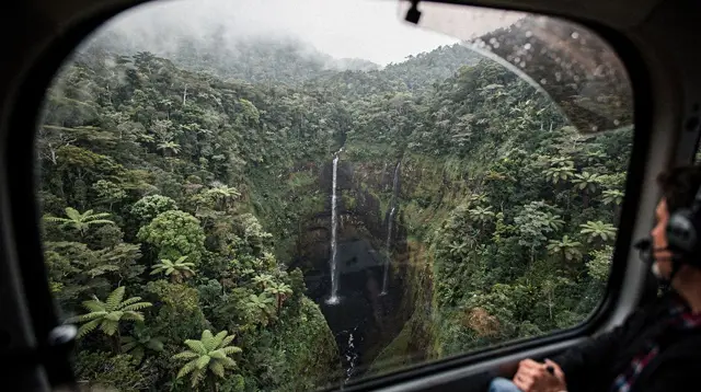
Leave Saint-Gilles-les-Bains on a clear, dry morning and the change is obvious within an hour: the scrubby, sun-bleached hillsides of the west give way to deep green, and by the time you reach the east coast, the air is noticeably more humid. Réunion Island sits with its dry side facing the trade winds’ shadow and its wet side facing straight into them, and Saint-Benoît and Sainte-Rose sit squarely on the wet side. That contrast, more than any single sight, is the reason to make the trip.
This guide treats the east coast as a single, organised day out from the west coast base most visitors use, not as a full regional write-up. It does not cover the Grand Brûlé or the Sud sauvage, which lie further south past Saint-Philippe and deserve their own trip, and it does not cover Piton de la Fournaise, which has its own guide. What follows is Saint-Benoît, the Rivière des Marsouins, and Sainte-Rose: enough for one well-paced day, with honest numbers on how long it actually takes to get there and back.
Getting there: think in time, not kilometres
The drive from Saint-Gilles to Saint-Benoît covers roughly 65 to 70 kilometres, but that figure is close to useless for planning. Réunion Island’s road network is not a grid; it is a ring road with mountainous interior shortcuts, and travel times depend far more on route and traffic than on distance.
| Leg | Distance | Typical driving time |
|---|---|---|
| Saint-Gilles to Saint-Denis | ~25 km | 30–45 min (longer at peak hours) |
| Saint-Denis to Saint-Benoît | ~45 km | 45–55 min |
| Saint-Benoît to Sainte-Rose | ~20 km | 25–35 min |
| Total, Saint-Gilles to Sainte-Rose | ~90 km | 1 h 45 min – 2 h 15 min one way |
The coastal road around Saint-Denis and the route littorale can back up badly during weekday morning and evening peak hours, so an early start, ideally before 7:30 a.m., avoids the worst of it and buys back time for stops later in the day. Renting a car is close to essential for this route; Car Jaune buses connect the coastal towns but are not built for a one-day loop with multiple stops. For general orientation on driving conditions around the island, including mountain roads elsewhere, a separate guide covers those specifics.
Saint-Benoît and the Rivière des Marsouins
Saint-Benoît is the east coast’s main town, a working agricultural and administrative centre rather than a resort. It is a reasonable first stop for coffee, fuel, and a look at the Cascade Biberon nearby, but the real draw for most day-trippers is the Rivière des Marsouins, a river running down from the island’s interior that is one of the more established spots for guided rafting and canyoning.
Morning departures are the norm here, both because tour operators run earlier slots and because water clarity and light are usually better before midday cloud builds up over the interior. A rafting descent on the Rivière des Marsouins gives a fast, guided introduction to the river without requiring prior experience, and works well as the first booked activity of the day since it fits a morning slot before the drive on to Sainte-Rose. For a slower, more technical alternative closer to Saint-Benoît, a canyoning and water-hiking route on the Rivière des Roches combines short abseils with pools and natural water features, again best booked for the morning.
Both activities are weather-dependent. After heavy rain upstream, operators can and do cancel or postpone for safety, since river levels on Réunion Island rise fast in steep terrain. If rafting or canyoning is the anchor of the day, build in flexibility rather than a tight afternoon schedule, and check conditions with the operator the evening before or the morning of the trip. This is a good general habit on Réunion Island: the ONF publishes trail and access closures after heavy rain, and river operators follow similar caution.
Beyond the water activities, Saint-Benoît sits in vanilla country. Bourbon vanilla, hand-pollinated flower by flower since the technique was developed on the island in the 19th century, is grown across small plantations in this region, and some welcome short visits. It is a slower, agricultural side of Réunion Island that has little in common with the beach clubs of Saint-Gilles, and worth 30 to 45 minutes even for visitors who are not particularly interested in agriculture, if only to see how labour-intensive the crop is.
Sainte-Rose: the Anse des Cascades and Notre-Dame-des-Laves
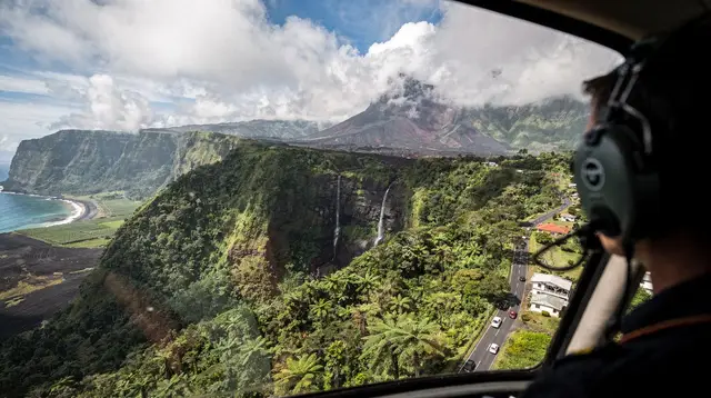
From Saint-Benoît, the coast road continues south toward Sainte-Rose, roughly 20 kilometres and 25 to 35 minutes further. This stretch is where the east coast’s character sharpens: dense vegetation right down to the shoreline, black volcanic rock, and a visibly wetter climate than anywhere on the west coast.
The Anse des Cascades, just north of Sainte-Rose town, is the standout stop. A short walk through a grove of coconut palms leads to a small cove where several waterfalls drop directly into the sea. There are picnic tables and shade, and it is a popular lunch stop for exactly that reason, but the shoreline is rocky and exposed, so this is a place to look rather than to swim. Arriving before midday tends to mean fewer people and better light for photos, since the site can fill up with tour groups in the early afternoon.
In Sainte-Rose itself, the church of Notre-Dame-des-Laves is one of Réunion Island’s genuinely unusual sights. During the 1977 eruption of Piton de la Fournaise, a lava flow advanced directly toward the village and split in two just before reaching the church, rejoining on the far side and leaving the building completely untouched. The solidified black lava is still visible right at the church’s entrance, stopped mid-flow. It takes only 10 to 15 minutes to see properly but is a striking, concrete illustration of how active the island’s volcanism is, without needing to visit the volcano itself.
For a broader look at Sainte-Rose’s agricultural side, a farm tour with a local brunch near Sainte-Rose pairs well with the Anse des Cascades and Notre-Dame-des-Laves as a midday or early-afternoon stop, since it comes with a seated meal rather than requiring a separate lunch stop.
What this day trip leaves out, deliberately
Two things sit further south along the same coast road and are easy to be tempted by once you are already in Sainte-Rose, but neither fits comfortably into a single day from Saint-Gilles alongside Saint-Benoît and the Anse des Cascades.
The Grand Brûlé and the Sud sauvage, the lava fields and rugged coastline past Saint-Philippe, are roughly another 30 to 40 minutes south of Sainte-Rose. Adding them means either cutting Saint-Benoît and Sainte-Rose short or getting back to Saint-Gilles well after dark on winding coastal roads, neither of which makes for a good day. They are better treated as their own trip, ideally combined with the Sud sauvage rather than the east coast.
Piton de la Fournaise itself is approached from a completely different direction, via the Route du Volcan from Bourg-Murat on the Plaine des Cafres, not from Sainte-Rose. It has its own logistics, its own weather window (early morning before the fog rolls in), and its own access rules depending on volcanic activity. Trying to fit the volcano into an east coast day from Saint-Gilles is one of the more common planning mistakes visitors make; the two are genuinely separate excursions.
If a longer loop through the interior appeals more than an out-and-back day trip, an itinerary covering the wild south and east coast over two days handles the pacing properly, with an overnight instead of a long drive home in the dark.
Suggested one-day route from Saint-Gilles
| Time | Stop | Notes |
|---|---|---|
| 6:30–7:00 a.m. | Depart Saint-Gilles | Earlier beats Saint-Denis traffic |
| 8:15–8:45 a.m. | Arrive Saint-Benoît | Coffee, fuel, orientation |
| 9:00–11:30 a.m. | Rafting or canyoning on the Rivière des Marsouins or Rivière des Roches | Book a morning slot; weather-dependent |
| 12:00–12:45 p.m. | Vanilla plantation stop | 30–45 min, optional |
| 1:15–2:15 p.m. | Anse des Cascades, Sainte-Rose | Lunch or picnic |
| 2:30–2:45 p.m. | Notre-Dame-des-Laves | Short stop, 10–15 min |
| 3:00 p.m. | Depart for Saint-Gilles | Allow 1 h 45 min – 2 h 15 min |
| 5:00–5:30 p.m. | Arrive back in Saint-Gilles | Before dark year-round |
This schedule is tight but realistic for the dry season (May to October). During the wetter months (November to April), build in more slack: rain can slow the interior crossing, and river activities are more likely to be postponed.
Weather and when to go
The east coast’s rainfall pattern is the single biggest planning factor for this trip. It receives considerably more rain than Saint-Gilles or Saint-Leu across the year, and that gap widens further during the austral summer (November to April), which is also Réunion Island’s cyclone season. A clear morning on the west coast does not guarantee dry conditions in Saint-Benoît or Sainte-Rose; checking a forecast specific to the east coast the night before, not just conditions in Saint-Gilles, avoids an unpleasant surprise.
The dry austral winter (May to October) is the more reliable window for this trip, with lower rainfall and steadier river conditions for rafting and canyoning. Even then, pack a light rain layer; a shower passing through for 20 minutes is normal on the windward coast and rarely worth cancelling plans over. For a month-by-month breakdown that applies across the whole island, see the weather by month guide; for the specific risks of travelling during the wetter months, the cyclone season guide covers what a vigilance alert or a confinement order actually means in practice.
Alternative and extended options
Travellers who want more time in the interior on the way to or from the east coast can build in the Plaine des Palmistes, a high plateau on the road between Saint-Denis and Saint-Benoît, as a scenic midpoint rather than a straight-through drive. A guided visit of the Plaine des Palmistes with lunch included turns the crossing itself into a stop rather than a stretch to get through, though it adds roughly 2 to 3 hours to the day and works better as a standalone excursion than combined with a full east coast itinerary.
For visitors who prioritise waterfalls and natural pools over the coastal sights, a private day trip focused on Réunion Island’s waterfalls and natural pools can be arranged to include stops in the east and interior, with a private guide adjusting the pace and route on the day rather than following a fixed itinerary. This suits travellers who would rather have flexibility built in from the start than assemble their own stops. For a broader list of options across the island, see best waterfalls and natural pools in Réunion.
Practical notes
Fuel up before leaving the west coast or in Saint-Denis; stations are less frequent once past Saint-Benoît. Cash is useful for smaller vanilla plantation stops and roadside stalls, even though cards are widely accepted in Saint-Benoît and Sainte-Rose themselves. Mobile signal is generally reliable along the main coast road but can drop in short stretches through the more forested sections, so download an offline map before setting out.
Closed shoes are more useful than sandals for the Anse des Cascades, where the ground is uneven volcanic rock, and for any waterfall or canyoning stop. If travelling during the wetter months, check with any booked tour operator the morning of the activity rather than assuming a booking made days in advance will proceed automatically.
For visitors deciding how many days to allocate to the island overall, and whether a single east coast day trip is enough or a longer stay including an overnight in the east makes more sense, how many days in Réunion Island sets out the trade-offs. And for a sense of how things to do here compare with the more polished, tourist-oriented west coast, the difference in pace is part of what makes the crossing worthwhile.
Frequently asked questions about the Saint-Benoît and Sainte-Rose day trip
How far is Saint-Benoît from Saint-Gilles?
About 65 to 70 kilometres by road, but count on 1 hour 15 minutes to 1 hour 30 minutes of driving rather than judging the distance in kilometres. The route crosses the island’s interior before dropping onto the east coast, and traffic around Saint-Denis can add time during peak hours.
Is the east coast worth a day trip if I am based in the west?
Yes, mainly for the contrast. The west coast is dry and sunny; the east coast, on the windward side, is noticeably greener and wetter, with waterfalls, vanilla plantations and a different rhythm. A single day gives a real sense of that difference without needing to relocate.
What is the Anse des Cascades?
A small cove near Sainte-Rose where several waterfalls drop directly into the sea through a grove of coconut palms. It has a public picnic area and is one of the most photographed spots on the east coast. Swimming is not advised here because of the rocky, exposed shoreline.
Why is the church at Sainte-Rose called Notre-Dame-des-Laves?
During the 1977 eruption of Piton de la Fournaise, a lava flow split in two just before reaching the village church and rejoined behind it, leaving the building untouched. The church was renamed Notre-Dame-des-Laves afterward, and the solidified lava is still visible at its entrance.
Can you go rafting on the Rivière des Marsouins?
Yes, guided rafting and canyoning trips run on the Rivière des Marsouins near Saint-Benoît, generally in the morning when water levels and light conditions are most consistent. Trips depend on rainfall and can be cancelled after heavy rain upstream, so a morning slot with flexible plans afterward is the safer choice.
Does this day trip include the volcano or the Grand Brûlé?
No. Piton de la Fournaise and the Grand Brûlé lava fields sit further south, past Saint-Philippe, and are usually visited as their own day trip via the Route du Volcan from Bourg-Murat, not tacked onto an east coast run from Saint-Gilles. Combining both in one day means too much driving and too little time at either.
What should I pack for the east coast if I am coming from the dry west?
A light rain layer even in the dry season, since the east coast receives significantly more rainfall than Saint-Gilles or Saint-Leu at any time of year. Closed shoes help around the Anse des Cascades and any waterfall stops, and a printed or offline map is useful since signal can be patchy in the more rural stretches.
Is vanilla farming still active around Saint-André and Saint-Benoît?
Yes. Bourbon vanilla, one of the island’s signature products, is grown and hand-pollinated across small plantations in this region, and some are open for short visits or tastings. It is a slower, more agricultural side of the island than the beach towns of the west.
Trip planning tours and activities on GetYourGuide
Verified deep-linked GetYourGuide tours. Book through these links and we earn a small commission at no cost to you.
GetYourGuide does not provide a product photo for this activity — the image shows the meeting point, photographed by us.