Rafting and canyoning in Saint-Benoît, on Réunion's wet east coast
Where do you go rafting and canyoning near Saint-Benoît?
The main run is on the Rivière des Marsouins, on Réunion's east coast, roughly 45 minutes from Saint-Denis and Roland-Garros airport. Trips include rafting, canoe-kayak, tubing and a water-hiking route, but all of them depend on rainfall and river level and can be cancelled after heavy rain.
A different kind of water activity, on a different coast
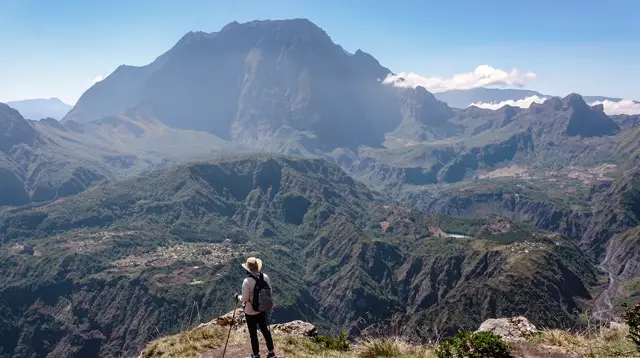
Most of what gets written about canyoning on Réunion points inland, to the mountain gorges above Cilaos. Saint-Benoît is a different proposition altogether. This is the east coast, the windward side of the island, and the water here runs through cane fields and forest rather than granite cirques. The river in question is the Rivière des Marsouins, and the activities built around it — rafting, canoe-kayak, tubing, and a guided water-hiking route — sit closer to sea level, in a warmer, wetter, greener landscape than anything you’ll find in the south-west.
It’s worth being upfront about what this page does and doesn’t cover. It’s about the Rivière des Marsouins near Saint-Benoît, not the canyons above Cilaos. If you’re looking for rappelling descents through narrow granite gorges, that’s a separate trip in a separate region, and this guide won’t send you there. What follows is specific to the east coast: where it is, what the river offers, and why the weather here changes the plan more often than it does almost anywhere else on the island.
Where Saint-Benoît sits on the map
Saint-Benoît is on Réunion’s North and East coast, part of the region locals and this guide both refer to as the North and East Réunion. It sits roughly 45 minutes by car south-east of Saint-Denis and of Roland-Garros airport (RUN) at Sainte-Marie, following the coast road down past Sainte-Suzanne and Saint-André. That makes it a realistic half-day or full-day trip from the north of the island rather than a separate place most visitors need to base themselves in overnight.
This guide won’t walk through Saint-Denis itself — the capital’s own sights, markets and streets are covered on the Saint-Denis destination page and in the things to do in Saint-Denis guide. What matters here is simply the orientation: if you’re staying in the north or flying in through Roland-Garros, the Rivière des Marsouins is close enough to fold into a day trip without an early start, and close enough to combine with the vanilla and sugar cane landscapes further along the coast toward Saint-André and Sainte-Rose.
Compared with the west coast around Saint-Gilles or Saint-Leu, where most visitors sleep, this is more of an excursion than a base. Expect a couple of hours of driving in total for the round trip, on top of the time spent on the water.
The Rivière des Marsouins: rafting, canoe-kayak and tubing
The Rivière des Marsouins is the river that carries most of the water-based activity around Saint-Benoît. Depending on the operator and the water level on the day, you can descend it by raft, by canoe or kayak, or lying on an inflatable tube — three different ways of covering broadly the same stretch of moving water, at different paces and different levels of effort.
a guided rafting descent of the Marsouins is the most active option: paddling as a group through the current, reading the water with a guide calling directions from the back of the raft. It suits people who want some physical involvement without technical skills, and groups who’d rather work together than drift.
For a calmer pace, a canoe, kayak and rafting outing on the same river lets you choose a gentler craft and control your own speed through the flatter sections, with faster water where the river narrows. It’s a reasonable middle ground for families with older children or anyone who’d rather not commit to a full rafting descent.
The most relaxed version is a tubing float down the Marsouins, which trades paddling for simply floating with the current on an inflatable ring. It’s the option most forgiving of a lack of upper-body effort, though it still puts you directly in the river, at the mercy of whatever the water level happens to be that day.
None of these are Cilaos-style canyoning: there’s no rappelling into a gorge, no jumping from rock ledges into plunge pools carved through granite. This is river descent on a lowland, forested watercourse — a different sport, in a different setting, and worth choosing deliberately rather than assuming it’s a substitute for one or the other.
Water-hiking near Saint-Benoît
Slightly more adventurous than a straight river descent is the guided water-hiking route offered around Saint-Benoît: a water-hiking tour that combines walking, wading and light scrambling along a watercourse near the town. It sits between hiking and canyoning — expect to get wet, to cross pools, and to move over slippery rock with a guide, without the rope work and vertical descents that define the canyons above Cilaos.
This kind of outing rewards a reasonable level of fitness and comfort in and around water more than technical experience. It’s a good option if straightforward rafting feels too passive but full canyoning gear and rappelling feel like more commitment than you want on this trip.
Why it rains more here than on the west coast
Réunion’s east coast, including Saint-Benoît, Saint-André and Sainte-Rose further south, sits directly in the path of the south-east trade winds that blow across the island for most of the year. Moist air pushed in off the Indian Ocean rises against the mountainous interior on this windward side and drops its rain here, well before it reaches the west coast around Saint-Gilles or Saint-Leu, which sits in the rain shadow and stays noticeably drier and sunnier.
That’s the reason the landscape around Saint-Benoît looks so different from the beaches most visitors picture when they think of Réunion: dense green vegetation, sugar cane fields, vanilla plantations, and rivers that carry a real volume of water rather than a trickle. It also means the weather plan for a day here should assume rain is more likely than on the west coast, even in the dry season, and build in a plan B.
| Coast | Typical feel | Rainfall pattern |
|---|---|---|
| East (Saint-Benoît, Sainte-Rose) | Green, humid, forested | Frequent rain year-round, heavier in austral summer |
| West (Saint-Gilles, Saint-Leu) | Dry, sunny, coastal | Rain shadow, noticeably drier most of the year |
When these activities run — and when they don’t
Rafting, canoe-kayak, tubing and water-hiking on the Rivière des Marsouins all depend directly on rainfall and river level, in much the same way hiking trails on Réunion depend on trail conditions checked with the ONF. After heavy or sustained rain, the river can rise and speed up beyond what’s safe for these trips, and operators will postpone or cancel departures. This isn’t a formality: river conditions on the east coast can change within a day, especially in the wetter austral summer months from November to April, which is also cyclone season.
The more reliable window tends to be the austral winter, from May to October, when the island as a whole is drier — though the east coast still receives meaningfully more rain than the west even then. Whatever the season, treat a booking as provisional rather than guaranteed, confirm conditions the day before if the operator allows it, and avoid stacking a tight itinerary immediately afterward in case of a last-minute cancellation.
| Activity | Typical duration | Effort level | Weather sensitivity |
|---|---|---|---|
| Rafting descent | 1.5–2.5 hours | Moderate to active | High |
| Canoe, kayak and rafting | 2–3 hours | Moderate | High |
| Tubing | 1–1.5 hours | Low | High |
| Water-hiking | 2–3 hours | Moderate | High |
Combining it with the rest of the east coast
Saint-Benoît sits within reach of some of the east coast’s other draws, which makes it easy to build into a fuller day rather than an isolated outing. Sainte-Rose, further south along the coast, offers a local farm and brunch visit that fits naturally with the vanilla and sugar cane theme of this stretch of coast, and pairs well with a morning on the river. Inland, toward the high plains, horseback riding around Grand Étang offers a slower, drier alternative for part of the same day if the river conditions aren’t cooperating.
For a broader look at the region, the east coast day trip guide sets out a fuller loop for visitors based on the west coast, and the wild south day trip guide covers the coastline further south for those extending the trip toward Saint-Philippe and the Grand Brûlé.
Getting there and getting around
A rental car is close to essential for reaching Saint-Benoît and the river access points; there is no practical way to reach the put-in points on foot or by relying solely on the Car Jaune interurban bus network, which serves the coastal towns but not the activity meeting points themselves. From Saint-Denis or Roland-Garros airport, follow the coast road south-east through Sainte-Marie and Sainte-Suzanne; allow around 45 minutes to an hour depending on traffic, longer at peak times.
Most operators specify a meeting point rather than a fixed departure location, so check the exact address on your booking confirmation rather than assuming it’s in the town centre itself. Parking near the river is generally straightforward outside peak holiday periods.
What to bring
- Swimwear worn under quick-dry clothing
- Water shoes or old trainers with a secure fit — sandals tend to come off in current
- A full change of clothes and a towel for afterwards
- A dry bag or waterproof phone pouch if you want to bring a phone at all
- Reef-safe sunscreen, reapplied — cloud cover on the east coast doesn’t mean no sun exposure
- A light rain layer, given how often showers pass through this side of the island
- Cash for parking or small purchases; card acceptance is less consistent away from the coastal towns
Rafting and canyoning near Saint-Benoît: frequently asked questions
Is the Rivière des Marsouins the same as the canyons at Cilaos?
No. The Rivière des Marsouins is a river descent on the east coast near Saint-Benoît, done by raft, kayak or tube on moving water. Cilaos, in the mountains of the south-west, has a separate set of canyoning routes with rappelling and jumps through narrow gorges. The two are different activities in different parts of the island.
Why is the east coast so much wetter than the west?
Réunion sits in the path of the south-east trade winds, which push moisture-laden air against the island’s eastern flank. That side, including Saint-Benoît and Sainte-Rose, catches far more rain over the year than the sheltered west coast around Saint-Gilles or Saint-Leu, which is why the vegetation, rivers and farming here look so different.
Can rafting or canyoning be cancelled because of rain?
Yes. Operators monitor river level and rainfall on the Rivière des Marsouins and its catchment closely. After heavy or sustained rain the current can become too fast or too high, and trips are postponed or cancelled for safety, in the same way mountain hiking trails get closed. Always confirm the day before departure rather than assuming a booking guarantees the activity will run.
How far is Saint-Benoît from Saint-Denis and the airport?
Saint-Benoît is on the North and East coast, about 45 minutes by car from Saint-Denis and from Roland-Garros airport (RUN), following the coast road south-east. It is a realistic half-day or full-day trip from the north, not a separate base most visitors need to stay in overnight.
Do you need experience to go rafting or canyoning here?
No prior experience is required for the standard rafting, canoe-kayak or tubing descents, which are guided and use grippy, family-friendly stretches of the Rivière des Marsouins. The water-hiking route asks for a reasonable level of fitness and comfort wading and scrambling over wet rock, but it is still framed as an introductory outing rather than a technical canyoning descent.
What should you bring for a river outing near Saint-Benoît?
Swimwear under quick-dry clothes, water shoes or old trainers you don’t mind getting wet, a change of clothes for afterwards, and a dry bag or waterproof pouch for your phone. Sun protection matters even on a cloudy east-coast day, and it’s worth carrying a light rain layer given how often showers pass through this side of the island.
Is this a good activity to combine with the vanilla and sugar cane area?
Yes. Saint-Benoît and the Sainte-Rose road sit in the heart of Réunion’s vanilla and sugar cane country, so a river morning pairs naturally with a farm visit or a tasting stop nearby. Treat it as one east-coast day rather than rushing back to Saint-Gilles or Saint-Denis immediately after.
Canyoning and river adventures on GetYourGuide
Verified deep-linked GetYourGuide tours. Book through these links and we earn a small commission at no cost to you.
GetYourGuide does not provide a product photo for this activity — the image shows the meeting point, photographed by us.