Is Reunion Island safe for tourists?
Is Reunion Island safe for tourists?
Yes, for most visitors, but a handful of specific risks are real: a shark-driven ban on swimming outside the lagoon, mosquito-borne dengue and chikungunya, leptospirosis after heavy rain, winding mountain roads with fast-moving fog, and a cyclone season from November to April. None of this should cancel a trip, but each one changes what you should and shouldn't do.
What actually goes wrong in Reunion Island
Reunion Island isn’t a dangerous destination, and most trips here pass without incident. But the island does have a short list of real, specific risks, and a good guide names them instead of hiding them behind reassurance. This page is where we put all of it in one place: what can genuinely go wrong, why, and what to do about it. We won’t repeat the beach-by-beach detail or the entry-formalities rules covered in other guides — this is strictly about safety.
The short version: swim where you’re told to swim, treat mosquitoes and freshwater with a bit of caution, drive mountain roads with respect for fog and distance, don’t assume the volcano crater will be open, and keep half an eye on the calendar between November and April. None of it is complicated once you know it.
Swimming: why you can’t just jump in anywhere
This is the single most important safety fact for Reunion Island, and it surprises a lot of first-time visitors: swimming and water sports outside the lagoon and outside supervised or protected zones are banned by prefectoral order, because of shark risk on this coastline. It isn’t a soft warning sign at the edge of a beach — it’s an enforced rule, and it exists because the open water beyond the reef has produced serious incidents over the years.
In practice, this changes very little about your trip. The lagoon — the shallow, reef-protected water running roughly from Saint-Gilles-les-Bains and the Hermitage down to La Saline-les-Bains, plus pockets around Saint-Leu, the Etang-Salé and Saint-Pierre — is exactly where locals and visitors swim, snorkel and paddle. It’s also where most organised water activities operate, because operators know the boundaries. Outside the lagoon, on the open coast, swimming and surfing are not worth the risk even if the water looks calm and inviting.
A gentler and fully sanctioned way to be on the water is a guided outing that stays within the rules: a snorkelling trip with sea turtles in the Saint-Gilles-les-Bains lagoon keeps you inside the protected zone the whole time. If you want to be on the water further out, that’s what boat trips are for rather than swimming: a boat excursion out from the west coast in search of dolphins and whales puts you on the sea safely, with a crew that knows the coastline.
For more detail on exactly where swimming is allowed, see our guides on where you can swim in Reunion Island and whether it’s safe to swim given sharks and beach rules, and the wider list of best beaches in Reunion Island.
Mosquitoes: dengue and chikungunya
Reunion Island has seen outbreaks of both dengue and chikungunya in recent years, both spread by daytime-biting mosquitoes rather than the night-biting species linked to malaria (there is no malaria risk on the island). Outbreaks tend to follow the wetter, hotter months of the austral summer, and the east coast’s higher rainfall makes it a more active zone than the drier west.
The precautions are ordinary but worth actually doing: use a DEET or picaridin-based repellent during the day, especially around dawn and dusk; wear long sleeves and trousers in the evening if you’re prone to bites; and if you’re staying somewhere with a garden or terrace, empty any standing water (plant saucers, buckets, old tyres) since that’s where the mosquitoes breed. None of this should stop you sitting outside for dinner — it’s a five-minute habit, not a change of itinerary.
Symptoms of both diseases include fever, joint pain and headache; if you develop these during or shortly after your trip, mention travel to Reunion Island to a doctor. Our mosquitoes, dengue and chikungunya guide has more on current outbreak status and what to pack.
Leptospirosis: the freshwater risk after rain
Less well known than the mosquito risk, but worth knowing before you head into a waterfall or a river: leptospirosis is a bacterial infection carried in freshwater contaminated by animal urine, and it’s present on Reunion Island as it is on many tropical islands with rivers and livestock. Risk rises noticeably after heavy rain, when runoff carries the bacteria into pools, rivers and the natural swimming holes (bassins) the island is known for.
The rule of thumb locals use: avoid swimming in rivers, waterfalls and freshwater pools for a few days after significant rainfall, and always avoid it if you have open cuts or scratches, which is how the bacteria typically enters. This matters for a lot of the island’s most photogenic stops — the pools below waterfalls in Salazie, the Langevin valley cascade in the wild south, the Anse des Cascades — so it’s worth checking recent weather before you plan a swim there, not just the forecast for the day itself.
Mountain roads and the fog that arrives without warning
The island’s roads are in good physical condition, but distance in kilometres is a poor guide to how long anything takes once you leave the coast. The road to Cilaos is the extreme example — around 400 bends climbing from Saint-Louis, roughly an hour of continuous, attentive driving without stopping — but the same logic applies to the road up to the Maido above Mafate and the route du Volcan from Bourg-Murat to the Pas de Bellecombe. Budget time in hours, not kilometres, and expect to be tired at the wheel by the end of a mountain day.
The other hazard on these roads is fog, which on Reunion Island’s high ground tends to build through the morning and can arrive fast enough to cut visibility to a few metres within minutes, typically from around mid-morning onward. This is the reason locals leave early for the Maido viewpoint or the volcano: not for the light, but because the window of clear visibility genuinely closes as the morning goes on. If you’re driving a mountain road and fog rolls in, slow down, use your lights, and treat blind bends as if something is coming the other way — because on a single-lane switchback, it might be.
See driving in Reunion Island and driving the road to Cilaos and its 400 bends for route-specific detail, and getting around Reunion Island for the bigger picture on car rental and the Car Jaune bus network as an alternative for coastal travel.
The volcano: when the crater area closes
Piton de la Fournaise is one of the most active volcanoes in the world, and that’s part of its appeal — but it also means the hike to the Dolomieu crater from the Pas de Bellecombe isn’t always open. During an eruption, or when monitoring by the OVPF-IPGP observatory raises the alert level, the prefecture can close access to the enclos Fouque, the caldera area the trail crosses. Eruptions themselves are relatively frequent on this volcano but genuinely unpredictable in timing, so no guide — including this one — can promise you’ll see lava or that the crater trail will be open on your specific date.
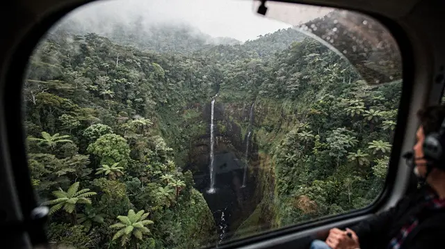
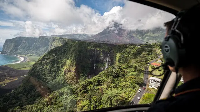
The practical approach: check current access status close to your visit date rather than planning around an assumption either way, have a backup plan for a foggy or closed day (the Cité du Volcan museum in Bourg-Murat is a solid one), and if you want the volcano experience without depending on trail access, a flight is a good alternative. A helicopter flight over the island departing from Saint-Gilles can pass over the volcano and the cirques regardless of whether the ground trail is open that day.
More on planning around this at Piton de la Fournaise: self-drive or guided tour and can you visit Piton de la Fournaise during an eruption?
Cyclone season: honest facts, no drama
Reunion Island’s seasons are the reverse of Europe’s, and this matters for safety planning: the austral summer, November to April, is also the cyclone season, with the highest concentration of activity typically in January to March. This isn’t a reason to avoid those months outright — most seasons pass without a direct hit on the island — but it is a reason to plan with some flexibility if you’re travelling then.
The prefecture uses a staged alert system, roughly in this order:
| Alert level | What it means | What you should do |
|---|---|---|
| Cyclonic vigilance | A system is being watched, no immediate threat | Keep checking updates, no change needed yet |
| Orange alert | A cyclone could affect the island within hours | Stock food and water, secure loose items, avoid non-essential travel |
| Red alert | Direct impact expected or underway | Mandatory confinement (confinement) — stay indoors, follow official instructions |
If a red alert is called, it typically means a day or two of staying put, not a ruined trip — flights and activities generally resume once the system passes. The honest advice: book accommodation and tours with flexible cancellation where possible if you’re travelling November to April, and buy travel insurance that explicitly covers cyclone disruption. Never assume a cyclone is likely or unlikely for a specific date this far out — the system simply isn’t predictable that early.
Full detail at Reunion Island cyclone season guide and what happens if a cyclone hits during your trip. For the dry, cooler counter-season that avoids all of this, see best time to visit Reunion Island and Reunion Island weather by month.
Sun, altitude, and everyday precautions
A few smaller risks round out the list, none of them dramatic but all worth a sentence. The tropical sun is strong even at altitude, and hikers heading up toward the Piton des Neiges or across the Plaine des Sables near the volcano regularly underestimate it because the air feels cool — sunscreen and a hat matter at 2,000 metres as much as on the beach. At the other end of the temperature scale, it can approach freezing near dawn at the volcano summit and on the Piton des Neiges in the austral winter (May to October), so a warm layer belongs in your bag even on an island most people picture as permanently hot.
If you’re heading into the cirques, especially multi-day routes into Mafate, tell someone your planned route and expected return, carry more water than you think you’ll need, and check trail status with the ONF before setting out — heavy rain can trigger landslides that close sections of trail with little notice. See hiking in Mafate: planning guide and best hikes in Reunion Island for route-specific planning, plus what to pack for Reunion Island for a fuller kit list.
For anyone who wants a broader look at the coast and its wildlife rather than the risk list, a whale and dolphin outing is a good, low-risk way to spend a morning on the water: a quad and buggy excursion through the Saint-Gilles-les-Hauts area is a land-based alternative on days when the sea or the mountain roads aren’t cooperating.
Emergency numbers
One number covers almost everything, and it’s worth knowing before you need it:
| Situation | Number |
|---|---|
| Any emergency (EU-wide) | 112 |
| Medical emergency (SAMU) | 15 |
| Police | 17 |
| Fire and rescue | 18 |
Calling 112 works from any phone, including a foreign SIM with no local credit, and dispatchers can usually direct you in French or English. Save it before you need it, not after.
Reunion Island safety: quick summary
None of the points above should be read as reasons to cancel a trip — they’re the specific, checkable things that make the difference between a good trip and a bad one on this particular island. Swim in the lagoon, use repellent in the evenings, be cautious about freshwater after rain, respect the fog and the time mountain roads actually take, check volcano access before committing to a summit hike, and travel with a flexible booking if you’re here between November and April. That’s the whole list.
Reunion Island safety FAQ
Is it safe to swim in Reunion Island?
Only in the lagoon and in supervised or protected zones. A prefectoral order bans swimming and water sports outside these areas because of shark risk, and it is enforced, not a suggestion.
Are there sharks in Reunion Island?
Yes, in the open coastal waters outside the lagoon, which is why the ban exists. Inside the lagoon, behind the coral barrier, the risk is considered low and this is where locals and visitors swim.
Does Reunion Island have dengue or chikungunya?
Both have caused outbreaks on the island in recent years, spread by daytime-biting mosquitoes. Repellent, long sleeves in the evening, and emptying standing water at your accommodation are the standard precautions.
What is leptospirosis and should I worry about it in Reunion Island?
It’s a bacterial infection picked up from freshwater contaminated by animal urine, and risk rises sharply after heavy rain. Avoid swimming in rivers, waterfalls or pools of standing freshwater for a few days after a big downpour.
Can you visit the volcano if it’s erupting?
Sometimes, from a distance, but the enclos Fouque (the area around the Pas de Bellecombe and the Dolomieu crater) can be closed by the prefecture during an eruption or alert. Check current access before planning a summit hike.
How dangerous is driving in Reunion Island?
The roads themselves are well maintained, but mountain routes like the road to Cilaos are narrow, bend constantly, and can be hit by fast-forming fog, usually from late morning. Slow down, start early, and don’t rely on distance in kilometres to estimate time.
Is Reunion Island dangerous during cyclone season?
Not routinely, but November to April is the cyclone season and the island has a clear alert system. Most seasons pass without a direct hit, and travel insurance with flexible dates is a sensible precaution rather than a sign of danger.
What is the emergency number in Reunion Island?
112, the single European emergency number, works from any phone and reaches police, fire and medical services. It’s the one number worth knowing before you need it.
Trip planning tours and activities on GetYourGuide
Verified deep-linked GetYourGuide tours. Book through these links and we earn a small commission at no cost to you.
GetYourGuide does not provide a product photo for this activity — the image shows the meeting point, photographed by us.