Getting around Réunion Island: choosing how to move
What is the best way to get around Réunion Island?
A rental car is the practical default for most visitors, since it is the only way to reach the Hauts, the Maïdo, Cilaos and the volcano on your own schedule. Car Jaune buses cover the coastal towns cheaply but slowly, and Mafate has no road at all — it is reached on foot or by helicopter.
Two airports, one island, and a lot of altitude
Most trips to Réunion Island start at one of two airports. Roland-Garros (RUN), near Sainte-Marie just east of Saint-Denis, handles the large majority of arrivals, including the long-haul routes from mainland France. Pierrefonds (ZSE), on the edge of Saint-Pierre in the south, is smaller and mostly serves regional flights from Mauritius and Madagascar. Which one you land at shapes your first day: from Roland-Garros you are close to Saint-Denis and the north; from Pierrefonds you are already in the south, near Saint-Pierre’s market and the Sud sauvage.
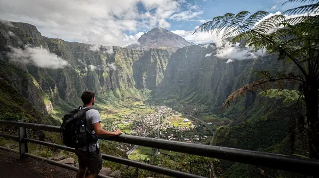
Neither airport puts you within easy reach of the whole island. Réunion Island is compact on a map — roughly 70 km across — but it is built around a volcanic massif that pushes population and roads to the coast and leaves the interior, the Hauts and the three cirques, accessible mostly by slow, winding roads or by trail. That single fact decides most of the transport question: do you need to reach the Hauts, or are you staying close to the coast?
Whichever airport you land at, getting from the tarmac to your first night’s accommodation is a separate question from getting around the island for the rest of the trip. If you’re staying near Saint-Gilles-les-Bains after flying into Roland-Garros, see Roland-Garros airport to Saint-Gilles for the drive time and your options before you’ve picked up a rental car.
This page is a starting point, not the full manual. Once you know roughly what you need, the dedicated guides go deeper: driving in Réunion Island for road conditions and mountain driving, renting a car for the practicalities of hiring one, and the Car Jaune guide for bus routes and timetables. Here, the goal is simply to help you choose between them.
The default: a rental car
For most visitors, a rental car is the practical default, not a luxury. It is close to the only way to reach the Maïdo belvedere at sunrise, drive up to Cilaos or Salazie on your own schedule, or reach the trailheads for Piton de la Fournaise before the mid-morning cloud rolls in. Public transport and organised tours can substitute for some of this, but they add waiting time and fixed schedules to an island where the best light and the clearest views often come very early in the morning.
Driving is on the right, following French rules and road signage, which is a non-event for most European visitors and a small adjustment for anyone used to the left. The road network itself is what takes getting used to: a two-lane coastal road (the Route du Littoral and its newer sections) links the main towns, while single roads climb into each cirque and up to the volcano, often with dozens of hairpin bends over a short horizontal distance. We cover the mechanics of that driving — the specific roads, conditions, and what to expect on each one — in the driving guide, and the logistics of hiring a car, insurance and pickup points in the car rental guide.
Why kilometres lie on this island
The single most useful thing to understand before planning any day here: a distance in kilometres tells you very little about how long a drive will take. Réunion Island’s interior roads gain and lose hundreds of metres of altitude over short distances, in tight bends, often behind slower vehicles or delivery trucks. The road up to Cilaos is the clearest example — a little over 30 km from Saint-Louis, but budget close to an hour of steady climbing without stops, on a road known locally for its roughly 400 bends (we cover it in detail in driving the road to Cilaos). The volcano road from Bourg-Murat to Pas de Bellecombe and the climb to the Maïdo above Saint-Paul follow the same pattern: short on the map, long in the car.
The practical rule we’d give anyone planning a Réunion itinerary is to always convert distance into time before committing to a day plan, and to build in a buffer for slower traffic, roadworks or fog. Two “nearby” places on a map — say Saint-Gilles-les-Bains and Cilaos — can easily be an hour and a half apart by road once the climb is factored in. We go through this in more detail, cirque by cirque and road by road, in the driving guide; here the point is just to plan around it rather than be surprised by it. For a sense of what a realistic day or week actually covers on this terrain, how many days in Réunion Island and the road trip around the island itinerary are useful starting points.
Car Jaune: useful on the coast, slow in the Hauts
Car Jaune is the island’s interurban bus network, and it is a reasonable way to move between coastal towns without a car — Saint-Denis to Saint-Pierre, or along the west coast towns near Saint-Gilles-les-Bains. Fares are low and the network is reliable for point-to-point coastal trips. Where it struggles is altitude: routes into the Hauts, to Cilaos, Salazie or the volcano, are limited, indirect or simply not served on a schedule that suits a day trip. If your plan stays close to sea level, Car Jaune can replace a rental car for parts of a trip; if it includes the cirques or the volcano, it will not get you there on time, or at all in some cases. The full network map, journey times and where it falls short are covered in the Car Jaune guide; this page is only flagging it as an option, not detailing it.
Car Jaune’s network is built around a small number of long trunk lines that follow the coast, rather than a dense grid, so a trip that isn’t a direct point-to-point coastal run often means a transfer and a longer wait. It works well for moving between Saint-Denis, Saint-Pierre and Saint-Leu without a car, and it’s a reasonable option for a car-free day out of Saint-Gilles-les-Bains, but it isn’t designed around visitor itineraries, and the timetable is worth checking before you build a day plan around it.
Organised tours and transfers, when you’d rather not drive
Between “rent a car” and “take the bus” sits a third option worth considering, particularly for a short stay or for the parts of the island that are hardest to self-drive: an organised tour or private transfer. A full guided loop of the island, such as the complete tour of Réunion Island covering its main sights over multiple stops, covers a lot of ground in a single well-paced day without anyone in the group having to navigate hairpin bends. It will not replace independent exploring, but it answers the “I have three days and no time to learn the roads” problem reasonably well.
For a different angle entirely, a scenic helicopter flight over the island departing from Saint-Gilles shows how the road network actually sits inside this terrain — cirques, ramparts, the volcano’s crater — in a way that is hard to grasp from inside a car. It is also, practically speaking, the only way to see Mafate’s interior without walking in. Closer to the coast, a boat trip along the west coast lagoon and shoreline is a way to cover distance and see the coastline without touching a steering wheel at all, and inland, a guided quad or buggy ride through the Hauts above Saint-Gilles-les-Hauts gets you into rougher terrain with a guide handling the route.
Choosing the right mode for the trip you have
| Mode | Best for | Weak point |
|---|---|---|
| Rental car | Reaching the Hauts, cirques and volcano on your own schedule | Mountain roads are slow and tiring to drive |
| Car Jaune bus | Low-cost travel between coastal towns | Limited, slow service into the Hauts and cirques |
| Organised day tour | Covering a lot in one day without driving | Fixed schedule, less flexibility |
| Helicopter | Seeing Mafate and the volcano from above | Short flights, weather-dependent, higher cost |
| On foot | The only way into Mafate | Requires fitness, planning and often an overnight gîte |
There is no single right answer, and most visitors end up mixing modes: a rental car for the bulk of the trip, perhaps a Car Jaune ride for a car-free day near Saint-Gilles-les-Bains, and a helicopter flight or a Mafate trek as a one-off. The Réunion Island for first-time visitors guide walks through how that mix typically looks over a week, and is Réunion Island safe for tourists covers the practical safety side of driving and hiking here.
Weather and cyclone season change how easily you can move around
How easily you get around the island also depends on when you’re travelling. Réunion Island’s seasons run opposite to Europe’s: the austral summer, from November to April, is hot and humid and is also the cyclone season, when heavy rain can close mountain roads, delay organised tours and ground helicopter flights with little notice. The austral winter, from May to October, is drier and cooler, and it’s generally the easier season for driving into the Hauts, hiking and flying over the island, since roads and trails are less likely to be affected by sudden weather closures.
If a cyclone or a major weather system is forecast during your stay, what happens if a cyclone hits during your trip and the cyclone season guide cover how that typically affects transport and bookings. For choosing when to go in the first place, best time to visit Réunion Island and Réunion Island weather by month go into more detail.
Phone signal and finding your way in the Hauts
Mobile signal is generally reliable along the coast but can drop out in the Hauts and inside the cirques, including parts of Mafate and stretches of the volcano road. EU roaming rules cover most visitors travelling from the European Union, but it’s still worth downloading offline maps before heading into the mountains, since a missed turn on a single-lane mountain road can add a long detour before there’s anywhere to turn around. For planning connectivity more broadly, see phone and internet in Réunion Island.
Mafate: the one place none of this applies
It is worth repeating plainly, because it is the single most common misunderstanding about getting around this island: Mafate has no road. None of the modes above — car, bus, tour minibus — reach its interior. The cirque is entered on foot, from trailheads at the Maïdo, the Col des Bœufs, Dos d’Âne or the Rivière des Galets, with routes that typically take a full day or more depending on the ilet you’re heading for, and an overnight stay is usually required. Helicopters supply the ilets and offer scenic flights over the cirque, but they are not a way to plan a hike-free visit to Mafate itself. If Mafate is part of your plan, start with the Mafate hiking planning guide and how to get into Mafate without a road rather than treating it as another driving destination.
The takeaway before you dig into the details
If you’re choosing a starting point: assume a rental car will do most of the work, budget real time rather than map distance for anything in the Hauts, treat Car Jaune as a coastal-only backup, and remember Mafate is walking territory, full stop. From here, the driving guide and car rental guide go into the mechanics of actually doing this on the ground, and do you need a car in Réunion Island makes the case for and against renting one in more detail. For budgeting the transport side of a trip alongside everything else, see Réunion Island trip cost.
Getting around Réunion Island: frequently asked questions
Do I need to rent a car in Réunion Island?
For most itineraries, yes. Buses run along the coast but rarely reach the Hauts, Cilaos, the Maïdo or the volcano road on a useful schedule, so a car is what makes those places practical to visit in a day.
Can I get around Réunion Island without a car?
It is possible around Saint-Gilles-les-Bains and the west coast, using Car Jaune buses, organised day tours and transfers, but it limits how much of the Hauts and the cirques you can reach independently.
What is Car Jaune and where does it go?
Car Jaune is Réunion Island’s interurban bus network. It connects the coastal towns — Saint-Denis, Saint-Pierre, Saint-Paul and others — reasonably well, but it is slow and limited once you leave the coast for the Hauts.
Which side of the road do people drive on in Réunion Island?
The right, as in mainland France. Road signs and rules follow French standards, which is straightforward for European visitors and worth double-checking for anyone used to driving on the left.
How long does it take to drive around the island?
The coastal ring road can be driven in a few hours, but that tells you little about a real trip: reaching Cilaos, the Maïdo or the volcano adds hours of winding mountain driving that a map distance does not show.
Which airport should I fly into, Roland-Garros or Pierrefonds?
Roland-Garros (RUN), near Saint-Denis in the north, handles the large majority of international and long-haul flights. Pierrefonds (ZSE), near Saint-Pierre in the south, is smaller and mainly serves regional connections.
Can you drive into Mafate?
No. Mafate has no road at all. It is reached on foot from trailheads such as the Maïdo or the Col des Bœufs, or by helicopter for supplies and scenic flights — never by car.
Getting around Réunion tours on GetYourGuide
Verified deep-linked GetYourGuide tours. Book through these links and we earn a small commission at no cost to you.
GetYourGuide does not provide a product photo for this activity — the image shows the meeting point, photographed by us.