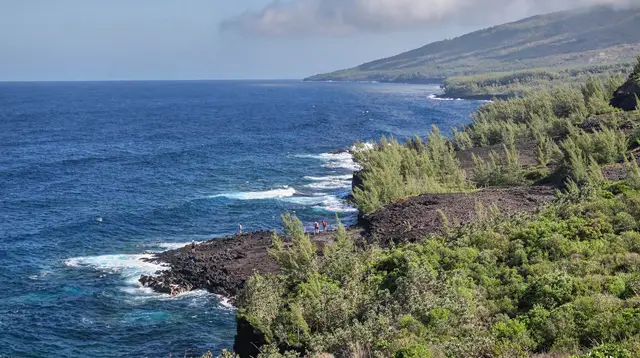
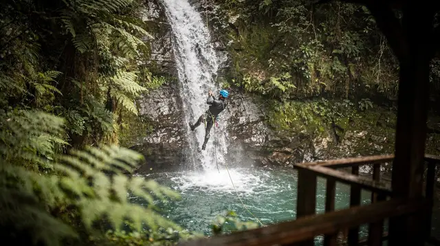
Guided hikes at the Maïdo and into Mafate
Can you drive into Mafate from the Maïdo?
No. The Maïdo road (from Saint-Paul) ends at a viewpoint above the cirque; Mafate itself has no road at all. Entry is on foot only, from trailheads including the Maïdo, the Col des Boeufs and the Rivière des Galets, and most hikes take one to three days with a night in a gîte.
The viewpoint and the cirque are two different trips
The Maïdo is a road-accessible belvedere at around 2,200 m, reached by car from Saint-Paul in the west. Mafate is the cirque it looks down on, and the two are often confused because the road makes the Maïdo feel like an entry point. It isn’t. The Maïdo road stops at the viewpoint; Mafate has no road anywhere inside it, and every step past the rim is on a footpath. A short visit to the Maïdo viewpoint is one outing. A guided hike down into Mafate, whether for a day or with a night in a gîte, is a different, longer commitment. This page covers the second: what a guided hike from the Maïdo actually involves, what the trailheads at the Col des Boeufs and the Rivière des Galets add as alternatives, and how to plan a stay in an ilet without discovering the gaps too late.
For the guided ascent of Réunion Island’s other major hiking objective, the volcano, see our separate Piton de la Fournaise volcano tours guide — a different massif, a different day, and not interchangeable with a Mafate hike. And if the plan is to see Mafate without walking, our helicopter flights from Saint-Gilles guide covers that option separately: flying over the cirque is not the same experience as descending into it on foot.
Why Mafate has no road
Mafate sits in a basin ringed by cliffs, cut off from vehicle access by the terrain that also makes it Réunion’s most isolated cirque. Its ilets — small hamlets such as La Nouvelle, Marla, Roche Plate, Grand Place and Aurère — receive supplies by helicopter or on foot, and residents and hikers alike move between them on marked trails. There is no construction planned to change this, and locals see the absence of a road as part of what keeps Mafate the way it is. Practically, this means:
- No car, taxi or shuttle can take you into the cirque at any point.
- Everything you carry in, you carry on your back (or it’s flown in for the gîtes).
- Mobile signal is patchy to absent in parts of the cirque.
- A guided hike is the most reliable way to see Mafate properly on a first visit, since a guide manages the trail choices, pacing and gîte bookings that a solo first-timer often gets wrong.
Mafate also sits inside the core zone of the Parc national de La Réunion, created in 2007, and forms part of the “Pitons, cirques et remparts” area inscribed as a UNESCO World Heritage Site in 2010. In practice this means hikers stay on the marked, maintained network of trails rather than cutting new routes, and it’s part of why the ONF’s trail-status information matters before setting out: closures protect both hikers and a landscape that’s protected by international designation, not just difficult terrain. For a broader look at safety planning across the island, including mountain trails, see is Réunion Island safe for tourists.
Trailheads into Mafate
| Trailhead | Access | Typical use |
|---|---|---|
| Maïdo | Car from Saint-Paul to the viewpoint, then footpath down | Descent into Mafate (e.g. toward La Nouvelle), or a short walk to the viewpoint only |
| Col des Boeufs | Car to Hell-Bourg / Salazie side, then footpath | Common entry from the east, often paired with a Salazie stay |
| Rivière des Galets | Footpath from the lowlands near Le Port | Longer, lower-altitude approach, less used by short guided trips |
| Dos d’Âne | Footpath from the village above Le Port | Alternative western approach |
All four are foot-only past their starting point. None of them is a road into the cirque itself.
A day from the Maïdo: viewpoint and short descent
A half-day guided outing from Saint-Paul typically covers the Maïdo viewpoint and a short walk along the rim or a partial descent toward the cirque, without an overnight stay. This suits visitors who want the panorama and a taste of the trail without committing to a gîte booking. For a short, guided version of this, see:
a half-day guided tour to the Maïdo viewpoint with views over MafateFor a shorter visit focused purely on the vantage point rather than any descent, there’s also:
a small-group visit to the Maïdo vantage pointArrive early. Cloud commonly builds over the cirque from around 10 a.m. as the day warms, and a viewpoint reached at noon can mean a wall of white instead of the panorama over La Nouvelle and the peaks beyond. Early morning also keeps a descent cooler, which matters on the climb back out.
Multi-day guided hikes into Mafate
A proper Mafate hike, one that reaches an ilet and returns, runs one to three days depending on the route and the number of ilets visited. A common structure:
- Day 1: descend from the Maïdo (or another trailhead) to an ilet such as La Nouvelle, roughly 3 to 4 hours of walking with around 700 to 900 m of descent; overnight in a gîte.
- Day 2: walk on to a second ilet, such as Marla or Roche Plate, or loop back partway; a further 4 to 6 hours depending on the route.
- Day 3 (if used): climb back out, typically the most demanding day, with 700 to 1,000 m of ascent to a rim trailhead.
Guided small-group hikes handle the route-finding, pacing and gîte logistics, which matters most on a first visit since junctions in Mafate are not always obvious and weather can change the plan mid-route. Two guided options that go directly into the cirque:
a small-group scientific guided hike through the Mafate cirque a guided group hike at Mafate CayenneExpect real physical effort: uneven volcanic terrain, exposed sections, and sustained climbs and descents rather than flat walking. This is not a stroll from a viewpoint car park. Hikers looking for an even higher-altitude challenge once Mafate is done often turn next to the Piton des Neiges summit hike, Réunion Island’s highest point and a different kind of multi-day effort entirely.
The ilets of Mafate
Mafate’s population lives scattered across a handful of ilets, each with its own character and each reachable only by the same network of footpaths. La Nouvelle, the largest and closest to the Maïdo trailhead, is the most commonly visited on a one- or two-day guided hike and has the most gîte beds. Marla, further in and higher, sits closer to the trailhead at the Col des Boeufs and is a common overnight on hikes that continue toward the Cilaos or Piton des Neiges side of the island. Roche Plate, Grand Place and Aurère lie deeper in the cirque or toward its western edge, and feature more on multi-day itineraries than on a single overnight. None of the ilets has a shop stocked the way a coastal town would be, so meals come from the gîte itself rather than anywhere else nearby, and choosing a specific ilet is really choosing its gîte.
Booking a gîte in Mafate
Gîtes in the ilets have a limited number of beds and no overflow option; arriving without a reservation can mean walking hours further to find space, or none at all. Book:
- Well ahead for the dry season (roughly May to October), which is also the best hiking weather.
- Through a guided operator if you’d rather not manage it yourself, since multi-day guided hikes typically include the gîte reservations in the package.
- With a flexible mindset on meals: most gîtes offer a fixed creole dinner and breakfast, not a menu.
For the planning detail beyond what this page covers, see our dedicated Mafate trek planning guide and the three-day Mafate trek itinerary.
What the Maïdo adds beyond the trailhead
Even without a step into Mafate, the Maïdo justifies the drive up from Saint-Paul on its own terms. The belvedere sits at the rim of the cirque, with a direct view down onto the ilet of La Nouvelle and, on a clear morning, across to the peaks ringing Mafate. The final stretch of road climbs through native highland forest, and short, flat paths run along the rim itself, letting anyone reach a genuine panorama without setting foot on the descent trail. Sunrise here is popular and cold; sunset works too, though afternoon cloud can already have filled the cirque by then, which is one more reason the early-morning window matters as much for the viewpoint alone as for a full descent.
This suits families or anyone wanting an outdoor half-day at altitude without a multi-hour hike. It’s a separate booking from any Mafate descent and works well paired with an early viewpoint visit before the clouds move in.
Weather and timing
Réunion’s seasons run opposite to Europe’s: the dry, cooler austral winter (May to October) is the better hiking window, with clearer skies and lower cyclone risk. The wet austral summer (November to April) brings heavier rain, especially in the Hauts, and is also cyclone season, so trail closures are more likely. Whatever the season, check trail status with the ONF before setting out, since heavy rain and rockfall can close sections of the Mafate network with little notice, and a guided operator will already be tracking this.
At altitude, mornings at the Maïdo can be genuinely cold, especially in austral winter; pack a warm layer even if Saint-Paul below is warm and sunny. Inside Mafate itself, the ilets sit lower and are generally milder, but weather in the cirque can shift within the day.
What to bring on a Mafate hike
A Mafate descent is not the kind of walk that forgives being underprepared. Sturdy hiking shoes with real grip matter more here than on flatter coastal trails, since the paths cross uneven volcanic terrain with loose sections. Carry more water than feels necessary; there is no shop to buy more once you’re on the trail, only what the gîte provides at the end of the day. A layer for cold mornings at the Maïdo, sun protection for exposed sections, and a rain layer regardless of season all belong in the bag, since weather in the cirque can shift within a single day even in the dry season. For a fuller island-wide packing list beyond what a Mafate hike specifically needs, see our guide on what to pack for Réunion Island.
Getting to the Maïdo trailhead
The Maïdo is reached by car from Saint-Paul on the west coast, a winding mountain road that takes roughly 45 minutes to an hour depending on traffic and stops, not a distance to judge by kilometres alone. There’s no public transport to the summit; a rental car, transfer or guided tour pickup is the only way up. For getting around the island more broadly, see our guide to driving in Réunion Island and to renting a car in Réunion Island.
Where this fits in a Réunion Island trip
A Maïdo viewpoint visit fits into almost any West Coast day from Saint-Gilles or Saint-Paul. A full Mafate hike is a bigger commitment and works best built into a longer stay; see our one-week Réunion Island itinerary or, for hikers prioritising trail time, the Réunion Island hiking week. For the island’s other cirques, which are accessible by road unlike Mafate, see Cilaos and Salazie and Hell-Bourg, and our comparison of Cilaos versus Salazie. Families weighing whether Mafate suits younger children should compare it against gentler options in our family-friendly hikes in Réunion Island guide, and anyone deciding between Réunion’s marquee trails more broadly can start with the best hikes in Réunion Island.
FAQ: Maïdo and Mafate guided hikes
Can you drive into Mafate from the Maïdo?
No. The Maïdo road ends at the viewpoint at around 2,200 m; from there, every route into the cirque of Mafate is a footpath. There is no road anywhere inside Mafate, only marked trails between the ilets.
How long does it take to hike from the Maïdo down into Mafate?
Reaching an ilet such as La Nouvelle from the Maïdo trailhead typically takes 3 to 4 hours of descent on uneven terrain, with a further climb back out on the return. Guided groups usually plan a full day for the descent alone, not a there-and-back afternoon.
What time should you arrive at the Maïdo viewpoint?
Early. Clouds commonly rise from the lowlands and fill the Mafate cirque from around 10 a.m., so a viewpoint visit or the start of a guided descent is best scheduled at first light for a clear panorama.
Do the Mafate gîtes need to be booked in advance?
Yes, well in advance, especially for ilets such as La Nouvelle and Marla during the June-to-October dry season. Gîtes have limited beds and no walk-in alternative; a guided multi-day itinerary books them as part of the package.
Is a guide necessary to hike into Mafate?
It isn’t legally required, but a guide is worth it for a first visit: trail junctions are easy to miss, weather changes fast, and a guide handles gîte logistics and pacing for descents and climbs of 700 to 1,000 metres of elevation change.
Can you see Mafate without walking into it?
Yes, from the Maïdo viewpoint itself, from other rim viewpoints, or by helicopter. Those are separate experiences from a guided hike, which puts you on the trails and, usually, inside one of the ilets overnight.
What is the difference between the Maïdo and Mafate?
The Maïdo is a road-accessible viewpoint on the western rim, reached by car from Saint-Paul. Mafate is the cirque it overlooks, a roadless basin of ilets reachable only on foot from the Maïdo and several other trailheads.
Guided hikes in the cirques and mountains on GetYourGuide
Verified deep-linked GetYourGuide tours. Book through these links and we earn a small commission at no cost to you.
GetYourGuide does not provide a product photo for this activity — the image shows the meeting point, photographed by us.